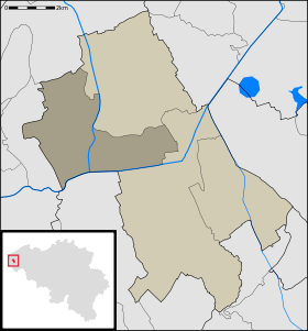
Pollinkhove
- Pollinkhove
-
Catégorie : - Commune avant fusion de l'arrondissement de Dixmude
Wikimedia Foundation.
2010.
Contenu soumis à la licence CC-BY-SA. Source : Article Pollinkhove de Wikipédia en français (auteurs)
Regardez d'autres dictionnaires:
Pollinkhove — is a village in Lo Reninge, in the Belgian province of West Flanders. See also: West FlandersThe Lovaart canal separates the village centre from the small city of Lo. The River Ijzer forms the south boundary.The church and parish are named after… … Wikipedia
Lo-Reninge — Lo Reninge Géolocalisation sur la carte : Belgique … Wikipédia en Français
Lo-reninge — Lo Reninge … Wikipédia en Français
Lo-Reninge — Infobox Belgium Municipality name=Lo Reninge picture= picture map arms=Lo Wapen.jpg region=BE REG FLE community=BE NL province=BE PROV WV arrondissement=Diksmuide nis=32030 pyramid date= 0 19= 20 64= 65= foreigners= foreigners date= mayor= Lode… … Wikipedia
List of postal codes in Belgium — Belgian postal codes are numeric and consist of 4 numbers, although the last one is often zero. The first digit indicates the province (except for the 3xxx numbers that are shared by the eastern part of Flemish Brabant and Limburg and the and… … Wikipedia
Lo-Reninge — Lo Reninge … Deutsch Wikipedia
Alveringem — Alveringem Géolocalisation sur la carte : Belgique … Wikipédia en Français
Arrondissement administratif de Dixmude — 51° 00′ N 2° 54′ E / 51, 2.9 … Wikipédia en Français
Arrondissement administratif de dixmude — Arrondissement de Dixmude … Wikipédia en Français
Liste Des Codes Postaux Belges — Liste des codes postaux pour la Belgique. Sommaire 1 1000 1299: Bruxelles Capitale 2 1300 1499 : Province du Brabant wallon 3 1500 1999: Province du Brabant flamand … Wikipédia en Français
 Belgique
 Région flamande
 Communauté flamande
 Province de Flandre-Occidentale


