Plymouth (New Hampshire)

Plymouth (New Hampshire)
Page d'aide sur l'homonymie Pour les articles homonymes, voir Plymouth.

43° 45′ 27″ N 71° 41′ 19″ W / 43.7575, -71.688611

Plymouth
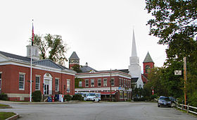
Image illustrative de l'article Plymouth (New Hampshire)
Administration
Pays Drapeau des États-Unis États-Unis
État New Hampshire New Hampshire
Comté Grafton
Site web Consulter
Historique
Fondation 1763
Municipalité depuis 1763
Démographie
Population (2003) 5 892 hab.
Densité 79 hab./km²
Géographie
Coordonnées 43° 45′ 27″ Nord
       71° 41′ 19″ Ouest
/ 43.7575, -71.688611
Superficie totale 74,4 km2
· dont terre 73,5 km2 (98,79 %)
· dont eau 0,9 km2 (1,21 %)
Fuseau horaire
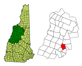
Voir la carte administrative
City locator 14.svg
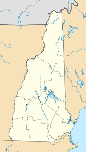
Voir la carte topographique
City locator 14.svg

Plymouth est une ville des États-Unis, située dans le New Hampshire, comté de Grafton, comptant 5 892 habitants au recensement de 2000. À Plymouth, il y a le Plymouth State University, l'hôpital commémoratif de Speare, l'école université-préparatoire de Holderness, et le Plymouth Regional High School (une école secondaire). Les cavernes polaires à Rumney sont une attraction.

Histoire

Plymouth était à l'origine l'emplacement d'un village Abénaki qui a été détruit par le capitaine Thomas Baker en 1712. C'était l'un des nombreux campagnes militaires des Britanniques pendant La Guerre de Reine Anne. La ville a été d'abord nommée New Plymouth, après la première colonie de Plymouth dans le Massachusetts. La ville a été incorporée en 1763. Pièces des villes d'Hébron et de Campton ont été annexées en 1845 et 1860.

En 1806, l'avocat Daniel Webster a perdu sa première affaire criminelle au palais de justice de Plymouth, qui abrite maintenant la Société historique. L'auteur Nathaniel Hawthorne, tout en vacances en 1864 avec l'ancien président américain Franklin Pierce, est décédé à Plymouth. Le Plymouth Normal School a été fondée en 1871. Il allait plus tard devenir Plymouth Teachers College en 1939, Plymouth State College en 1963 et, enfin, l'Université d'Etat de Plymouth en 2003.

Géographie

La ville s'étend sur 74,4 km², dont 0,9 km² d'eau.

Démographie

Au jour du dernier recensement de 2000, la ville comptait 5 892 personnes, 1 678 foyers et 941 familles. La densité de population s'élevait à 80,1/km².


Wikimedia Foundation. 2010.

Contenu soumis à la licence CC-BY-SA. Source : Article Plymouth (New Hampshire) de Wikipédia en français (auteurs)

Игры ⚽ Поможем решить контрольную работу

Regardez d'autres dictionnaires:

  • Plymouth, New Hampshire — Infobox Settlement official name = Plymouth, New Hampshire nickname = motto = Bridging the Lakes Region and the White Mountains postal code type = Zip Code postal code = 03264 imagesize = image caption = Congregational Church Town Hall, Plymouth… …   Wikipedia

  • New Hampshire locations by per capita income — New Hampshire is the seventh richest state in the United States of America, with a per capita income of $23,844 (2000) and a personal per capita income of $34,702 (2003). New Hampshire counties ranked by per capita income There are ten counties… …   Wikipedia

  • Plymouth Municipal Airport (New Hampshire) — Infobox Airport name = Plymouth Municipal Airport nativename = nativename a = nativename r = image width = caption = IATA = 1P1 ICAO = K1P1 FAA = 1P1 type = Public owner = operator = Town of Plymouth, New Hampshire city served = location =… …   Wikipedia

  • Plymouth Regional High School (New Hampshire) — Infobox school | name = Plymouth Regional High School name2=Plymouth Regional High School, Plymouth, New Hampshire imagesize= motto= established=1970 type=High School address= 86 Old Ward Bridge Rd., location = Plymouth, New Hampshire, 03264… …   Wikipedia

  • New Hampshire communities by population — The 234 incorporated cities and towns in the New Hampshire ranked by population, from the 2010 United States Census. Location of New Hampshire in the United States …   Wikipedia

  • New Hampshire communities by household income — The 234 incorporated cities and towns in the New Hampshire ranked by household income, calculated in 2006, and published in 2007. Rank Community Median Household Income 1 Windham, New Hampshire $94,794 2 Hollis, New Hampshire $92,847 3 …   Wikipedia

  • New Hampshire Route 175A — Route information Auxiliary route of NH 175 Maintained by NHDOT …   Wikipedia

  • New Hampshire — • The most northerly of the thirteen original states of the United States Catholic Encyclopedia. Kevin Knight. 2006. New Hampshire     New Hampshire      …   Catholic encyclopedia

  • New Hampshire Route 3A — Route information Auxiliary route of US 3 Maintained by NHDOT Lengt …   Wikipedia

  • New Hampshire Route 25 — Route information Maintained by NHDOT Length: 96.62 mi …   Wikipedia

Share the article and excerpts

Direct link
Do a right-click on the link above
and select “Copy Link”