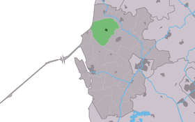
Pingjum
Contenu soumis à la licence CC-BY-SA. Source : Article Pingjum de Wikipédia en français (auteurs)
Regardez d'autres dictionnaires:
Pingjum — is a village in the municipality of Wûnseradiel in Friesland, in the northern Netherlands. [CathEncy|wstitle=Mennonites] References … Wikipedia
Penjum — Pingjum 53°6′56″N 5°26′23″E / 53.11556, 5.43972 … Wikipédia en Français
De Welstand — (Pingjum,Нидерланды) Категория отеля: 4 звездочный отель Адрес: Molenlaan 52, 8749 TH Pi … Каталог отелей
Menno Simons — Stich aus dem 17. Jahrhundert zeigt Menno Simons mit Krückstock und Bibel Menno Simons (* 1496 in Witmarsum; † 23. oder 31. Januar 1561 in Wüstenfelde bei Bad Oldesloe) war ein niederländisch friesischer Theologe. Simons war einer der führenden… … Deutsch Wikipedia
Menno Simons — from Friesland 1608 engraving by Christoffel van Sichem Church Mennonites Personal details Born … Wikipedia
List of places in the Netherlands — This is an alphabetical list of places (cities, towns, villages) in the Netherlands. Lists per province can be found at:* List of towns in Groningen * List of towns in Friesland * List of towns in Drente * List of towns in Overijssel * List of… … Wikipedia
Wûnseradiel — Infobox City official name = Wûnseradiel other name = Wonseradeel mapsize = 280px subdivision type = Country subdivision name = Netherlands subdivision type1 = Province subdivision name1 = Fryslân area footnotes = (2006) area total km2 = 317.68… … Wikipedia
B. D. Dykstra — Broer Doekeles (B.D.) Dykstra (November 11 1871 March 29 1955) was a Dutch American pastor, educator, and poet who wrote several books, served as editor of the Volkskrant Dutch language newspaper, and was a visible member of the Reformed Church… … Wikipedia
Gale Hania — ( 1380) was the thirteenth potestaat (or ruler) of Friesland, a province of Netherlands.BiographyHis name is also known written as Hanja or Hanya. Gale was born on the Hanya farm northeast of Pingjum, in the shire of Wonseradeel. The path… … Wikipedia
Kloster Bloomkamp — Zisterzienserabtei Bloomkamp Lage Niederlande Provinz Friesland Koordinaten: 53° 14′ N … Deutsch Wikipedia
 Pays-Bas

