- Phuntsholing
-
Phuntsholing 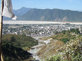
Vue de PhuntsholingAdministration Pays  Bhoutan
District Chukha Culture et démographie Population 20 537 hab. Géographie Coordonnées Superficie km² 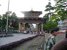
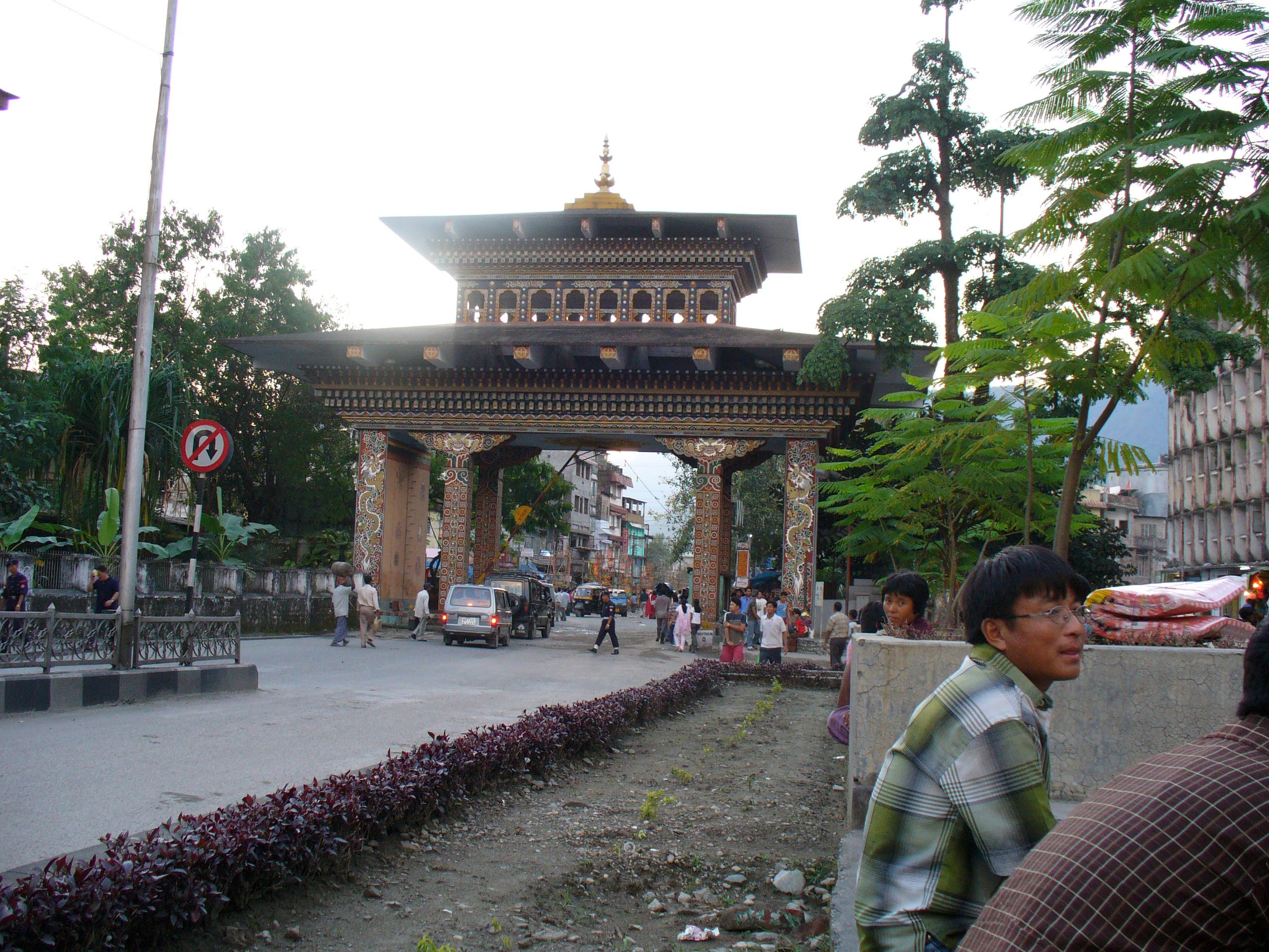
Phuntsholing (ou Phuentsholing), ཕུན་ཚོགས་གླིང་ en dzongkha est la seconde ville la plus peuplée du Bhoutan, elle comptait 20 537 habitants en 2005[1]. Située le long de la frontière avec l'Inde elle est la principale porte d'entrée vers ce pays himalayen enclavé et est de ce fait l'un des grands centres commerciaux du Bhoutan.
Sommaire
Localisation
Phuntsholing est localisée dans le district de Chukha au sud-ouest du Bhoutan, au pied des contreforts himalayens dans la plaine du Dwar[2] une frange étroite de basses-terres d'à peine 15 km de large s'étirant le long de la frontière[2] qui constitue elle-même une petite partie de la vaste plaine du Gange-Brahmapoutre et dont le nom signifie « porte d'accès » en Hindi. La ville est bordée à l'ouest par la rivière de Torsa Chhu venue du Tibet qui poursuit son cours en Inde. Ville frontière[3], Phuntsholing est située en face de la localité de Jaigaon dans l'État indien du Bengale-Occidental.
Accès
La ville n'est accessible que par la route. Au sud-ouest l'aéroport de Bagdogra qui dessert Darjeeling est situé à 170 km[4]. Siliguri, important nœud ferroviaire du Bengale est situé à entre 6 et 8 heures de route en autobus [réf. nécessaire]. Une chaussée construite dans les années 1960, la première du pays, dessert l'intérieur du Bhoutan qui n'était auparavant accessible qu'à pied. Il faut 6 heures depuis Phuntsholing pour se rendre dans la capitale Thimphu située à 176 km[4]. Phuntsholing est l'unique porte d'entrée permettant aux touristes étrangers d'entrer au Bhoutan par la voie terrestre[4],[5].
Activités commerciales
Le commerce transfrontalier en fait l'une des villes les plus dynamique du pays, elle est le siège de la banque du Bhoutan[6].
Voir aussi
frontière entre le Bhoutan et l'Inde
Notes et références
- (en) Cet article est partiellement ou en totalité issu de l’article de Wikipédia en anglais intitulé « Phuntsholing » (voir la liste des auteurs)
- (en)Bhutan: largest cities and towns and statistics of their population, World Gazetteer. Consulté le 2008-07-11
- (en)Bhutan: Society and Polity, Ramakant, Ramesh Chandra Misra, Indus Publishing, 1996, p.23 (ISBN 81-7387-044-6)
- (en)bhutaneseusa.org
- (en)Tourism council of Bhutan
- (en)First-time Asia,Lesley Reader, Lucy Ridout, Rough Guides, 2003, p.13 (ISBN 1-84353-048-1)
- (en)(en) Tan Chwee Huat, Chwee Huat Tan, Dictionary of Asia Pacific Business Terms, NUS Press, 2004, 488,p.29 p. (ISBN 9971-69-275-9)


Wikimedia Foundation. 2010.