Perämeri
- Perämeri
-
Baie de Botnie
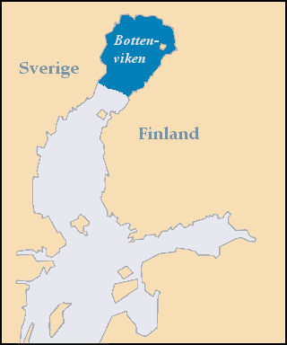
La baie de Botnie, en finnois Perämeri, en suédois Bottenviken, est une baie de la mer Baltique, plus précisément du golfe de Botnie. Elle se situe entre la Suède à l'ouest et la Finlande à l'est, tout au nord du golfe de Botnie et communique avec la mer de Botnie située au sud par le Kvarken.
 Portail du monde maritime
 Portail de la Suède
 Portail de la Finlande
Catégories : Golfe de Botnie | Géographie de la Suède | Baie | Baie de Finlande
Wikimedia Foundation.
2010.
Contenu soumis à la licence CC-BY-SA. Source : Article Perämeri de Wikipédia en français (auteurs)
Regardez d'autres dictionnaires:
Perämeri National Park — Geobox|Protected Area name = Perämeri National Park native name = Perämeren kansallispuisto other name = other name1 = category local = National Park of Finland category iucn = II image size = image caption = country = Finland country state =… … Wikipedia
Perämeri-Nationalpark — Bottenwiek Nationalpark … Deutsch Wikipedia
List of national parks of Finland — Map of all coordinates from Google Map of all coordinates from Bing Export all coordinates as KML … Wikipedia
Bottnische Bucht — Karte der Bottenwiek Die Bottenwiek (schwedisch Bottenviken, finnisch Perämeri) ist ein Teil der Ostsee zwischen Schweden und Finnland. Sie nimmt den nördlichen Teil des Bottnischen Meerbusens ein und wird im Süden durch die Meerenge Kvarken von… … Deutsch Wikipedia
Bahía de Botnia — Saltar a navegación, búsqueda Bahía de Botnia (Bottenviken Perämeri) La bahia de Botnia helado frente a la ciudad finesa de Kemi (febrero 2008) … Wikipedia Español
Ostrobothnia (historical province) — Historical province of Ostrobothnia (the borders of modern provinces with pink colour and the modern border of Finland, same as at the signing moment of final act of CSCE 1975) Ostrobothnia, Finnish: Pohjanmaa (literally Northern land ) and… … Wikipedia
Hailuoto — ( Karlö in Swedish) is an island and a municipality in the province of Oulu, Finland. The population of Hailuoto is 1000 (2007) and the municipality covers an area of 196.56 km² (excluding sea areas) of which 2.64 km² is inland water (2004 12 31) … Wikipedia
Nuuksio National Park — Coordinates: 60°18′27″N 24°29′57″E / 60.3075°N 24.49917°E / 60.3075; 24.49917 … Wikipedia
Oulanka National Park — Coordinates: 66°22′32″N 29°20′19″E / 66.37556°N 29.33861°E / 66.37556; 29.33861 … Wikipedia
Tiilikkajärvi National Park — Coordinates: 63°40′N 028°18′E / 63.667°N 28.3°E / 63.667; 28.3 … Wikipedia

 Finlande
 Suède
Suède