Parrsboro
Contenu soumis à la licence CC-BY-SA. Source : Article Parrsboro de Wikipédia en français (auteurs)
Regardez d'autres dictionnaires:
Parrsboro — Hauptstraße von Parrsboro Lage in Nova Scotia … Deutsch Wikipedia
Parrsboro — Original name in latin Parrsboro Name in other language State code CA Continent/City America/Halifax longitude 45.40015 latitude 64.33205 altitude 29 Population 1472 Date 2008 04 11 … Cities with a population over 1000 database
Parrsboro Harbour — is a Canadian harbour located in Cumberland County, Nova Scotia.Situated on the north shore of the Minas Basin at its western boundary, the harbour is fed by several fresh water sources:* Farrell River (through the Parrsboro Aboiteau) * Mill… … Wikipedia
Parrsboro Regional High School — teaches students in grades 7 to 12 from the area surrounding Parrsboro, Nova Scotia, Canada. The school sports teams are called the Warriors. An elevator has been constructed recently at the School for accessibility … Wikipedia
Parrsboro, Nova Scotia — Infobox Settlement official name = Pagename other name = native name = nickname = settlement type = Town motto = Parrsboro Rocks imagesize = image caption = Main Street Parrsboro flag size = image seal size = image shield = shield size = image… … Wikipedia
Minas Basin — The Minas Basin is an inlet of the Bay of Fundy and a sub basin of the Fundy Basin located in Nova Scotia, Canada. It is known for its extremely high tides. A view of the Southern Bight of the Minas Basin from The Lookoff … Wikipedia
Gillespie House Inn — (Parrsboro,Канада) Категория отеля: 4 звездочный отель Адрес: 358 Main Street, PO Box 879 … Каталог отелей
Cumberland County, Nova Scotia — Cumberland County County Flag … Wikipedia
Cumberland Railway and Coal Company — The Cumberland Railway and Coal Company is a defunct Canadian industrial company with interests in coal mines in Springhill, Nova Scotia, and a railway that operated from Springhill Junction to Parrsboro. Contents 1 Spring Hill and Parrsborough… … Wikipedia
List of schools in Nova Scotia — Nearly all primary and secondary schools in the province of Nova Scotia are public schools maintained by the provincial government s Department of Education. While providing guidelines, the government divides administration of public education… … Wikipedia
 Canada
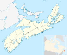
 Nouvelle-Écosse