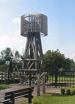
Paasloo
- Paasloo
-
52° 48′ 47″ N 6° 00′ 50″ E / 52.8131, 6.01389
Paasloo est un village néerlandais, situé dans la commune de Steenwijkerland, en Overijssel.
Le village est situé dans le nord-ouest d'Overijssel, entre Steenwijkerwold et Oldemarkt. Son église réformée date du XVIe siècle ; le nef de cette église a été construit d'après la forme d'une ferme typique de cette partie d'Overijssel.
En 1840, le village comptait 61 maisons et 348 habitants[1].
Avant 1973, Paasloo appartenait à la commune d'Oldemarkt. Du 1er janvier 1973 jusqu'au 31 décembre 2000, le village faisait partie de la commune d'IJsselham. Depuis 2001, Paasloo fait partie de la commune de Steenwijkerland.
Dans le cimetière de Paasloo sont enterrés les écrivains néerlandais J.C. Bloem et Clara Eggink.
Références
- ↑ Alphabetisch register van alle bewoonde oorden des Rijks, Departement van Oorlog, Éd. Erven Doorman, 's-Gravenhage, 1850
Wikimedia Foundation.
2010.
Contenu soumis à la licence CC-BY-SA. Source : Article Paasloo de Wikipédia en français (auteurs)
Regardez d'autres dictionnaires:
Landgoed Spinnerskaampe — (Paasloo,Нидерланды) Категория отеля: Адрес: Spinnerslaan 5, 8378 JD Paaslo … Каталог отелей
De Paasloërhof — (Paasloo,Нидерланды) Категория отеля: Адрес: Binnenweg 33, 8378 JJ Paasloo, Нидерлан … Каталог отелей
Villapark de Weerribben — (Paasloo,Нидерланды) Категория отеля: Адрес: Binnenweg 12, 8378 JJ Paasloo … Каталог отелей
Steenwijkerland — Héraldique … Wikipédia en Français
Steenwijkerland — Infobox Settlement official name = Steenwijkerland mapsize = 280px subdivision type = Country subdivision name = Netherlands subdivision type1 = Province subdivision name1 = Overijssel area footnotes = (2006) area total km2 = 321.69 area land km2 … Wikipedia
List of places in the Netherlands — This is an alphabetical list of places (cities, towns, villages) in the Netherlands. Lists per province can be found at:* List of towns in Groningen * List of towns in Friesland * List of towns in Drente * List of towns in Overijssel * List of… … Wikipedia
Steenwijkerland — Gemeinde Steenwijkerland Flagge Wappen Provinz Overijssel … Deutsch Wikipedia
Baarlo (Steenwijkerland) — 52°44′16″N 5°57′0″E / 52.73778, 5.95 … Wikipédia en Français
Baars — 52°48′48″N 6°5′26″E / 52.81333, 6.09056 … Wikipédia en Français
Basse (Overijssel) — 52°48′16″N 6°1′56″E / 52.80444, 6.03222 … Wikipédia en Français
 Pays-Bas

