Orfasay
- Orfasay
-
Orfasay est une île des Shetland.
Wikimedia Foundation.
2010.
Contenu soumis à la licence CC-BY-SA. Source : Article Orfasay de Wikipédia en français (auteurs)
Regardez d'autres dictionnaires:
Orfasay — (Old Norse: Orfyrisey, meaning tidal island ) is one of the Shetland Islands. Geography Orfasay is a tidal island in Yell Sound, connected to Yell at low tide. This is reflected in the island s name.[1] It is near the mouth of Hamna Voe and… … Wikipedia
Список Шетландских островов — Шетландский архипелаг … Википедия
Yell, Shetland — Infobox Scottish island | GridReference=HU492935 celtic name= norse name=Jala meaning of name=Possibly of Pictish origin or from Old Norse for barren area=21,211 ha area rank=11 highest elevation=Hill of Arisdale 210 m Population=957 population… … Wikipedia
Oronsay — This is a list of islands called Oronsay (Scottish Gaelic: Orasaigh (help·info)), which provides an index for islands in Scotland with this and similar names. It is one of the more common names for Scottish islands. The names come from… … Wikipedia
List of Shetland islands — This is a list of Shetland islands in Scotland. The Shetland archipelago is located 100 kilometres (62 miles) north of mainland Scotland and the capital Lerwick is almost equidistant from Bergen in Norway and Aberdeen in Scotland. The Shetland… … Wikipedia
Muckle Holm, Yell Sound — For other uses, see Muckle Holm. Muckle Holm is a small island in Shetland. It is in Yell Sound, near the Northmavine. It is 23m at its highest point. There is a lighthouse, first lit in 1976.[1] References ^ Muckle Holm . Shetlopedia.… … Wikipedia
Liste britischer Inseln — Lage der Britischen Inseln Diese Liste führt die wichtigsten der etwa 600 Inseln der Britischen Inseln auf. Politisch sind diese Inseln Teil des Vereinigten Königreiches, der Republik Irland und der Isle of Man, die als Kronbesitz kein… … Deutsch Wikipedia
Liste der Britischen Inseln — Lage der Britischen Inseln Diese Liste führt die wichtigsten der etwa 600 Inseln der Britischen Inseln auf. Politisch sind diese Inseln Teil des Vereinigten Königreichs, der Republik Irland und der Isle of Man, die als Kronbesitz kein Bestandteil … Deutsch Wikipedia
U 68 (Kriegsmarine) — U 68 (vorheriges/nächstes –alle U Boote) Typ: IX C Feldpostnummer: M 29 442 Werft: AG Weser, Bremen … Deutsch Wikipedia
Index alphabétique maritime — Projet:Maritime/Index Projet maritime Bistro du port Participants Actualités Agenda Outils À faire … Wikipédia en Français
 Royaume-Uni
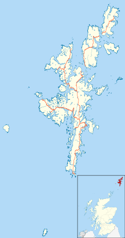
 Orfasay

