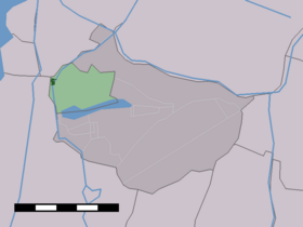
Oostknollendam
Contenu soumis à la licence CC-BY-SA. Source : Article Oostknollendam de Wikipédia en français (auteurs)
Regardez d'autres dictionnaires:
Oostknollendam — Town … Wikipedia
Wormerland — Infobox Settlement official name = Wormerland mapsize = 280px flag size = 150x75px image shield = Wormerland wapen.png shield size = 150x75px subdivision type = Country subdivision name = Netherlands subdivision type1 = Province subdivision name1 … Wikipedia
Wormerland — Womerland Héraldique … Wikipédia en Français
List of places in the Netherlands — This is an alphabetical list of places (cities, towns, villages) in the Netherlands. Lists per province can be found at:* List of towns in Groningen * List of towns in Friesland * List of towns in Drente * List of towns in Overijssel * List of… … Wikipedia
West-Knollendam — Dutch town locator maps mun town caption = The town centre (dark green) and the statistical district (light green) of West Knollendam in the municipality of Zaanstad.West Knollendam (coord|52|31|N|4|47|E|type:city(468)) is a town in the Dutch… … Wikipedia
Wormer — is a town in the Dutch province of North Holland. It is a part of the municipality of Wormerland, and lies about 13 km northwest of Amsterdam.In 2006, the town of Wormer had 12566 inhabitants. The built up area of the town is 16.88 km² (of which… … Wikipedia
Wormer — Gemeinde Wormerland Flagge Wappen Provinz Nordholland … Deutsch Wikipedia
Wormerland — Gemeinde Wormerland Flagge Wappen Provinz Nordholland Bürgermeister … Deutsch Wikipedia
Jisp — 52°30′22″N 4°51′14″E / 52.50611, 4.85389 … Wikipédia en Français
Jisp (Hollande septentrionale) — Jisp 52°30′22″N 4°51′14″E / 52.50611, 4.85389 … Wikipédia en Français