Mullaghcleevaun
- Mullaghcleevaun
-
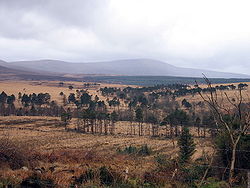
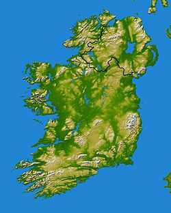
Mullaghcleevaun (en irlandais : Mullach Cliabháin) est le deuxième plus haut sommet des montagnes de Wicklow après le Lugnaquilla. Il est localisé au centre du massif, à 3 km de la Route militaire. Un petit lac est situé au pied de la montagne.
Il existe un deuxième sommet dénommé Mullaghcleevaun East Top ayant une altitude de 795 m.
Notes et références
Voir aussi
Wikimedia Foundation.
2010.
Contenu soumis à la licence CC-BY-SA. Source : Article Mullaghcleevaun de Wikipédia en français (auteurs)
Regardez d'autres dictionnaires:
Mullaghcleevaun — Mullach Cliabháin Mullaghcleevaun summit and Lough Cleevaun … Wikipedia
Mullaghcleevaun — Wicklow Mountains Die Wicklow Mountains (irisch Sléibhte Chill Mhantáin) sind ein Gebirgszug im Osten und Südosten von Irland. Sie verlaufen in Nord Süd Richtung, direkt vom Süden Dublins über die Grafschaft Wicklow in die Grafschaft Wexford … Deutsch Wikipedia
Wicklow Mountains — Coordinates: 53°04′52″N 6°23′24″W / 53.08111°N 6.39°W / 53.08111; 6.39 … Wikipedia
Mount Leinster — Stua Laighean Mount Leinster with its TV transmitter Elevation … Wikipedia
Mountain peaks of the Wicklow Mountains — 1 Lugnaquilla 2 Mullaghcleevaun … Wikipedia
Lugnaquilla — Wicklow Mountains Die Wicklow Mountains (irisch Sléibhte Chill Mhantáin) sind ein Gebirgszug im Osten und Südosten von Irland. Sie verlaufen in Nord Süd Richtung, direkt vom Süden Dublins über die Grafschaft Wicklow in die Grafschaft Wexford … Deutsch Wikipedia
Montagnes de Wicklow — Géographie Altitude 925 m, Lugnaquilla Longueur 66 km Largeur … Wikipédia en Français
Уиклоу (горы) — У этого термина существуют и другие значения, см. Уиклоу. Горы Уиклоу англ. Wicklow Mountains ирл. Sléibhte Chill Mhantáin … Википедия
List of mountains in Ireland — This is a list of mountains and mountain ranges on the island of Ireland. The list works around the island, beginning in Munster, and working anti clockwise. County allocations are based on where the majority of the mountain range lies.… … Wikipedia
List of Marilyns in Ireland — A list of the Marilyns of the Republic of Ireland. In the British Isles, a Marilyn is a hill with a relative height of at least 150 metres.*Carrauntoohil 1,038 m *Cnoc na Péiste 988 m *Brandon Mountain 951 m *Lugnaquilla 924 m *Galtymore 917 m… … Wikipedia

 Irlande

