Mata-utu
- Mata-utu
-
Mata-Utu
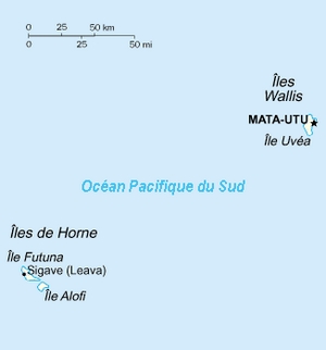
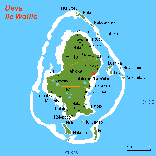
Mata-Utu est le chef-lieu de Wallis-et-Futuna. Elle est située sur l'île de Wallis et compte 1400 habitants.
Géographie
Le climat y est de type équatorial. Le fuseau horaire est GMT + 12 heures.
Toponymie
Cette section est vide, pas assez détaillée ou incomplète. Votre aide est la bienvenue !
Histoire
Cette section est vide, pas assez détaillée ou incomplète. Votre aide est la bienvenue !
Administration
Cette section est vide, pas assez détaillée ou incomplète. Votre aide est la bienvenue !
Démographie
Cette section est vide, pas assez détaillée ou incomplète. Votre aide est la bienvenue !
Personnalités liées à la commune
Cette section est vide, pas assez détaillée ou incomplète. Votre aide est la bienvenue !
Économie
Cette section est vide, pas assez détaillée ou incomplète. Votre aide est la bienvenue !
Lieux et monuments
Cette section est vide, pas assez détaillée ou incomplète. Votre aide est la bienvenue !
Cultes
Notes et références
Voir aussi
Article connexe
Liens externes
 Portail de l’Océanie
Catégorie : Géographie de Wallis-et-Futuna
Wikimedia Foundation.
2010.
Contenu soumis à la licence CC-BY-SA. Source : Article Mata-utu de Wikipédia en français (auteurs)
Regardez d'autres dictionnaires:
Mata-Utu — Matāʻutu Location of Mata Utu … Wikipedia
Mata-Utu — Matā utu Mata Utu Bandera … Wikipedia Español
Mata'utu — Administration Pays France Collectivité Wallis et Futuna (chef lieu) Code Insee abr. 98613 … Wikipédia en Français
Mata-Utu — ch. l. du territoire français d outre mer des îles Wallis et Futuna dans l île d Uvéa; 815 hab … Encyclopédie Universelle
Mata-Utu — Original name in latin Mata Utu Name in other language Gorad Mata Utu, Mata Utu, Mata utu, Mata Outou, Mata Utu, Matauto, Mat utu, Matutu, ma ta wu tu, mata atw, mata xu tu, matautoMata Utuu, matautu, Горад Мата Уту, Мата Уту, State code WF… … Cities with a population over 1000 database
Matá'Utu — Lage von Mata Utu Mata Utu (auch Matá Utu geschrieben) ist der größte Ort auf der Südsee Insel Uvéa. Die Insel gehört zum Archipel der Wallis Inseln, welches mit den Horn Inseln das französische Überseeterritorium Wallis und Futuna bildet. Die… … Deutsch Wikipedia
Mata-Utu — 13° 16′ 54″ S 176° 10′ 25″ W / 13.281667, 176.173611 … Wikipédia en Français
Mata-Utu — Lage von Mata Utu Mata Utu (wallisianisch Matāʻutu) ist der größte Ort auf der Südsee Insel Uvea. Die Insel gehört zum Archipel der Wallis Inseln, welches mit den Horn Inseln das französische Überseegebiet Wallis und Futuna bildet. Mata Utu ist… … Deutsch Wikipedia
Matâ'Utu Cathedral — (Cathédrale Notre Dame de l Assomption de Matâ Utu) is a Roman Catholic cathedral, and a national monument of France, located in the town of Matâ Utu on Uvea, in Wallis and Futuna. External links Location of the cathedral Coordinates … Wikipedia
Stade de Mata-Utu — is a multi use stadium in Mata Utu, Wallis and Futuna. It is currently used mostly for football matches. The stadium holds 1,500 people … Wikipedia