Lyttelton Harbour
Contenu soumis à la licence CC-BY-SA. Source : Article Lyttelton Harbour de Wikipédia en français (auteurs)
Regardez d'autres dictionnaires:
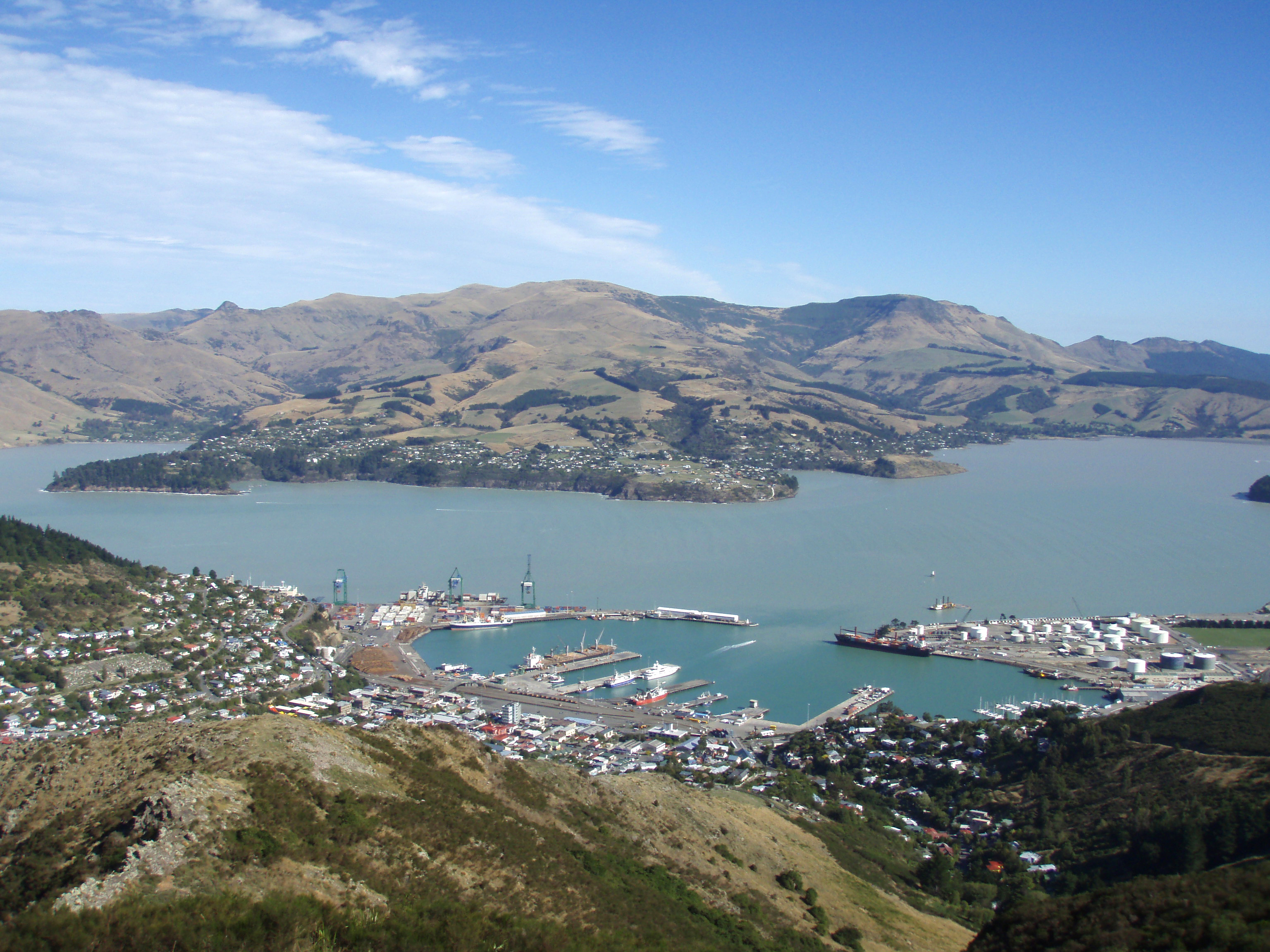
Lyttelton Harbour — is one of two major inlets in Banks Peninsula, on the coast of Canterbury, New Zealand. (The other is Akaroa Harbour.)It is approximately 15 km in length, from its mouth to Teddington. Its main centre is the Port of Lyttelton, which serves the… … Wikipedia
Lyttelton — Lyttelton … Deutsch Wikipedia
Lyttelton — Lyttelton … Wikipedia Español
Lyttelton, New Zealand — Infobox Settlement name = Lyttelton area total km2 = 14.4362 population as of = 2006 population total = 3072 population density km2 = auto image caption = Lyttelton on a sunny day map caption = Location of Lyttelton Lyttelton (coord|43.6000|S|172 … Wikipedia
Lyttelton — ▪ New Zealand town and port, eastern South Island, New Zealand. It is situated within the Christchurch urban area and on Lyttelton Harbour, an inlet of the southwest Pacific extending 8 miles (13 km) into the north shore of Banks Peninsula … Universalium
Lyttelton Line — Infobox rail line name = Lyttelton Line color = logo width = image width = caption = Map of the Lyttelton Line route. type = Urban rail transit system = New Zealand Government Railways Department status = Operational, freight only locale =… … Wikipedia
Lyttelton rail tunnel — Infobox tunnel name = Lyttelton Tunnel caption = Heathcote portal of the Lyttelton rail tunnel in Christchurch. line = Main South Line location = Christchurch, New Zealand coordinates = coord|43|35|32.15|S|172|42|45.55|E|region:NZ| status = Open… … Wikipedia
Diamond Harbour, New Zealand — … Wikipedia
Charles Lyttelton, 10th Viscount Cobham — The Right Honourable The Viscount Cobham KG, GCMG, GCVO, TD, PC Lord Cobham in September 1957 … Wikipedia
Christchurch–Lyttelton Motorway — The Christchurch–Lyttelton Motorway, also known as the Tunnel Road is part of the road network connecting Christchurch, New Zealand with its port town of Lyttelton. The 6.1 km road was completed in 1964 with the opening of the Lyttelton road … Wikipedia
 Lyttelton Harbour
 Portail de la Nouvelle-Zélande
 Portail du monde maritime