Angeren
Contenu soumis à la licence CC-BY-SA. Source : Article Angeren de Wikipédia en français (auteurs)
Regardez d'autres dictionnaires:
Angeren — Flagge Wappen Provinz Gelderland Bürgermeister … Deutsch Wikipedia
Angeren — is a town in Gelderland in the municipality of Lingewaard. It has a population of about 3000, and is located 2 km to the south of Huissen.The symbol of Angeren is Het keuje . ( The pig ) and there is a small statue of it in the center of the… … Wikipedia
Lingewaard — Infobox Settlement official name = Lingewaard mapsize = 280px subdivision type = Country subdivision name = Netherlands subdivision type1 = Province subdivision name1 = Gelderland area footnotes = (2006) area total km2 = 69.18 area land km2 =… … Wikipedia
Either/Or — For the Elliott Smith album, see Either/Or (album). For the game show, see Either/Or (TV series). Either/Or … Wikipedia
Betuweroute — The Betuweroute is a double track freight railway from Rotterdam to Germany. Betuweroute is the official name, after the Betuwe area through which it passes, but the line is popularly referred to as Betuwelijn, after an older track in the same… … Wikipedia
List of places in the Netherlands — This is an alphabetical list of places (cities, towns, villages) in the Netherlands. Lists per province can be found at:* List of towns in Groningen * List of towns in Friesland * List of towns in Drente * List of towns in Overijssel * List of… … Wikipedia
Nederrijn — Coordinates: 51°58′11″N 5°21′8″E / 51.96972°N 5.35222°E / 51.96972; 5.35222 … Wikipedia
Pannerdens Kanaal — and so improve river traffic and water regulation.The canal, now indistinguishable from a real river, forks off north from river Waal a few kilometres past the point where the Bijlands Kanaal, a similar canal dug to cut off a Waal bend, ends. It… … Wikipedia
Oude Rijn (Gelderland) — Satellite image of the Rhine Waal fork showing the Oude Rijn bend (bright red). Oude Rijn ( Old Rhine ) is the name of a long former bend in river Rhine in the Dutch province of Gelderland … Wikipedia
Lingewaard — Gemeinde Lingewaard Flagge Wappen Provinz … Deutsch Wikipedia
 Pays-Bas
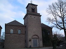 Une église d'Angeren
 Catégories :
