Angeles National Forest
- Angeles National Forest
-
Forêt nationale d'Angeles
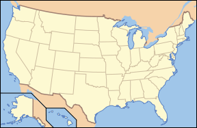
La Angeles National Forest (ANF) a été établie le 20 décembre 1892 sous le nom de San Gabriel Timberland Reserve. Elle s'étend sur 2 652 km² (655 387 acres) et est située dans les San Gabriel Mountains, juste au nord de l'aire urbaine du Grand Los Angeles, en Californie. Les paysages de la Forêt sont divers et les hauteurs varient entre 365 et 3,067 m d'altitude. Elle est en grande partie recouverte par un chaparral dense, et par des forêts de pin et de sapin dans les hauteurs. Le Pacific Crest Trail passe par la Angeles Forest.
Les principaux sommets sont:
- Mount San Antonio, 3067 m, aussi connu sous le nom de Mt. Baldy
- Pine Mountain, 2940 m
- Dawson Peak, 2918 m
- South Mount Hawkins, 2372 m
- Vetter Mountain, 1800 m
- Mount Wilson, 1740 m, où se trouve un observatoire
Voir aussi
 Portail de la conservation de la nature
 Portail du bois et de la forêt
 Portail des États-Unis
 Portail de la Californie
Catégories : Aire protégée de l'UICN - catégorie VI | Comté de Los Angeles | Géographie de la Californie | Forêt des États-Unis | Forêt nationale des États-Unis | Pacific Crest Trail
Wikimedia Foundation.
2010.
Contenu soumis à la licence CC-BY-SA. Source : Article Angeles National Forest de Wikipédia en français (auteurs)
Regardez d'autres dictionnaires:
Angeles National Forest — articleissues cleanup = March 2008 prose = March 2008The Angeles National Forest (ANF) was established on July 1 1908, incorporating the first San Bernardino National Forest and parts of Santa Barbara and San Gabriel National Forests. It covers… … Wikipedia
Angeles National Forest Fire Lookout Association — The Angeles National Forest Fire Lookout Association ( ANFFLA ) is a non profit 501(c)(3) organization of citizen volunteers dedicated to the preservation, restoration and operation of the fire lookout towers in the Angeles National Forest, Los… … Wikipedia
Windy Gap Trail (Angeles National Forest) — Infobox Hiking trail Name=Windy Gap Trail Photo=windy gap trail.jpg Caption=View along the Windy Gap Trail Location=California, United States Length=2 mi; 3.22 km Start/End Points=Crystal Lake Campground above Azusa, California Windy Gap near… … Wikipedia
National Forest — Tongass Nationalforst in Alaska Ein Nationalforst (engl. National Forest) ist in den Vereinigten Staaten von Amerika ein Waldgebiet unter der Kontrolle der Bundesregierung, das vom US Forest Service verwaltet wird. Größter Nationalforst ist mit… … Deutsch Wikipedia
National Forest Adventure Pass — The National Forest Adventure Pass is a recreation fee pass issued by the United States Forest Service that permits bearers in the four National Forests in Southern California to park their cars for the purpose of recreation. Though it was… … Wikipedia
Los Padres National Forest — Infobox protected area | name = Los Padres National Forest iucn category = VI caption = locator x = locator y = location = nearest city = Santa Maria, California lat degrees = lat minutes = lat seconds = lat direction = long degrees = long… … Wikipedia
San Bernardino National Forest — has two main divisions which are the San Bernardino Mountains on the easternmost of the Transverse Range, and the San Jacinto and Santa Rosa Mountains on the northernmost of the Peninsular Range. Covering more than 800,000 acres (3,200 km²), with … Wikipedia
San Gabriel National Forest — was established as the San Gabriel Forest Reserve by the General Land Office in California on December 20, 1892 with 555,520 acres. After the transfer of federal forests to the U.S. Forest Service in 1905, it became a National Forest on March 4,… … Wikipedia
Mendocino National Forest — IUCN Category VI (Managed Resource Protected Area) Rattlesnake Creek … Wikipedia
Sequoia National Forest — IUCN Category VI (Managed Resource Protected Area) … Wikipedia
 États-Unis

