Angaston
- Angaston
-
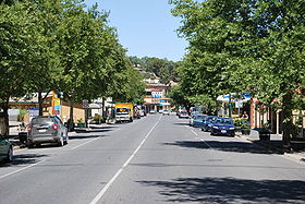
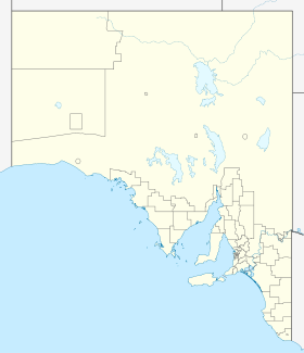
Angaston (1 865 habitants) est une localité située dans la vallée Barossa à 75 km au nord-est d'Adélaïde en Australie-Méridionale. Elle a été fondée par George Fife Angas, l'un des premiers pionniers de la région.
Références
Sur les autres projets Wikimedia :
Wikimedia Foundation.
2010.
Contenu soumis à la licence CC-BY-SA. Source : Article Angaston de Wikipédia en français (auteurs)
Regardez d'autres dictionnaires:
Angaston — Staat: Australien Bundesstaat … Deutsch Wikipedia
Angaston — Original name in latin Angaston Name in other language Angaston, Ангастон State code AU Continent/City Australia/Adelaide longitude 34.50129 latitude 139.04625 altitude 353 Population 2214 Date 2012 02 28 … Cities with a population over 1000 database
Angaston, South Australia — Infobox Australian Place | type = town name = Angaston state = sa caption = Angaston painted by George French Angas in the 1840s lga = Barossa Council postcode = 5353 pop = 1,865 2006 Census Census 2006 AUS id=UCL401000 name=Angaston (Urban… … Wikipedia
Angaston — /ˈæŋgəstən/ (say angguhstuhn) noun a town in southern SA in the Barossa Valley; farming and fruit growing area; wine industry. {named after George Fife Angas. See Angas family} …
Bethany (Barossa Valley) — Barossa Valley Basisdaten Bundesstaat South Australia Geografische Lage … Deutsch Wikipedia
Nuriootpa (Barossa Valley) — Barossa Valley Basisdaten Bundesstaat South Australia Geografische Lage … Deutsch Wikipedia
Tanunda (Barossa Valley) — Barossa Valley Basisdaten Bundesstaat South Australia Geografische Lage … Deutsch Wikipedia
Barossa Valley — Basisdaten Bundesstaat South Australia Geografische Lage … Deutsch Wikipedia
Barossa Light & Gawler Football Association — The Barossa Light Gawler Football Association (BL GFA) is an Australian rules football competition based chiefly in the Barossa Valley region of South Australia, Australia. Only forty two kilometres north of the state capital of Adelaide, the BL… … Wikipedia
Freeth — Sir Gordon Freeth, KBE (* 6. August 1914 in Angaston, South Australia; † 27. September 1994) war ein australischer Politiker und unter anderem Außenminister des Landes. Freeth wurde in Angaston, South Australia geboren und besuchte die Sydney… … Deutsch Wikipedia
 Australie


