Aneth (Utah)
- Aneth (Utah)
-
37° 12′ 20″ N 109° 09′ 52″ W / 37.205556, -109.164444
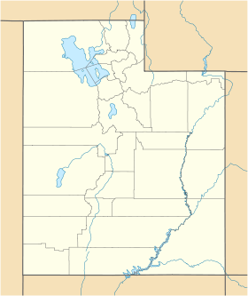
Aneth est une census-designated place américaine située dans le comté de San Juan, dans l’Utah. Selon le recensement de 2000, sa population s’élève à 598 habitants. Densité : 6 hab./km² (15,5 hab./mi²). Superficie totale : 30,4 km² (11,7 mi²).
Aneth est peuplée à 98,83 % par des Navajos. Le nom navajo d’Aneth est T'áá Bíích'į́į́dii.
Histoire
Au début des années 1880, c’est un lieu de commerce avec les Navajos. Son nom est Holyoak en 1886, puis il est changé en Anseth aux alentours de 1900, avant de prendre son nom actuel, d’après le nom d’un des pionniers qui a peuplé la région.
Source
Wikimedia Foundation.
2010.
Contenu soumis à la licence CC-BY-SA. Source : Article Aneth (Utah) de Wikipédia en français (auteurs)
Regardez d'autres dictionnaires:
Aneth, Utah — Infobox Settlement official name = Aneth, Utah settlement type = CDP nickname = motto = imagesize = image caption = image mapsize = 250px map caption = Location of Aneth, Utah mapsize1 = map caption1 = subdivision type = Country subdivision name … Wikipedia
Utah locations by per capita income — See also: List of cities in Utah Utah has the thirty ninth highest per capita income in the United States of America, at $18,185 (2000). Its personal per capita income is $24,977 (2003). Utah counties ranked by per capita income There are twenty… … Wikipedia
Aneth — Aneth, UT U.S. Census Designated Place in Utah Population (2000): 598 Housing Units (2000): 177 Land area (2000): 11.403941 sq. miles (29.536070 sq. km) Water area (2000): 0.323057 sq. miles (0.836715 sq. km) Total area (2000): 11.726998 sq.… … StarDict's U.S. Gazetteer Places
Aneth, UT — U.S. Census Designated Place in Utah Population (2000): 598 Housing Units (2000): 177 Land area (2000): 11.403941 sq. miles (29.536070 sq. km) Water area (2000): 0.323057 sq. miles (0.836715 sq. km) Total area (2000): 11.726998 sq. miles… … StarDict's U.S. Gazetteer Places
Utah State Route 262 — Infobox road state=UT type=SR route=262 section=132 maint=UDOT length mi=22.605 length round=3 length ref=cite web | title=State Route 262 Highway reference | publisher=Utah Department of Transportation |… … Wikipedia
National Register of Historic Places listings in San Juan County, Utah — Location of San Juan County in Utah This is a list of the National Register of Historic Places listings in San Juan County, Utah. This is intended to be a complete list of the properties and districts on the National Register of Historic Places… … Wikipedia
Montezuma Creek, Utah — CDP Location of Montezuma Creek, Utah Coordinates … Wikipedia
Navajo Mountain, Utah — CDP Location of Navajo Mountain, Utah Coordinates … Wikipedia
Oljato-Monument Valley, Utah — Oljato Monument Valley CDP Post Office in Monument Valley … Wikipedia
Monticello, Utah — City San Juan County Courthouse … Wikipedia
 Pour la plante de la famille des Apiacées, voir aneth odorant.
 États-Unis
 Utah
Utah