Caney Fork River
- Caney Fork River
-
Caney Fork
La Caney Fork ((en) Caney Fork River) est une rivière des États-Unis, affluent de la rivière Cumberland et qui fait partie du bassin du fleuve Mississippi par l'Ohio.
Parcours
La rivière prend sa source dans le comté de Cumberland à environ 10 kilomètres à l'ouest de Crossville, au centre de l'État du Tennessee. Le barrage Great Falls a créé un grand lac de barrage sur la rivière au niveau du comté de DeKalb. La rivière s'écoule ensuite vers le nord-ouest pour se jeter dans la rivière Cumberland en face de la ville de Carthage, siège du comté de Smith.
Principaux affluents
Liens externes
Notes et références
 Portail de l’eau
 Portail des États-Unis
Catégories : Cours d'eau du Tennessee | Système hydrologique du Mississippi
Wikimedia Foundation.
2010.
Contenu soumis à la licence CC-BY-SA. Source : Article Caney Fork River de Wikipédia en français (auteurs)
Regardez d'autres dictionnaires:
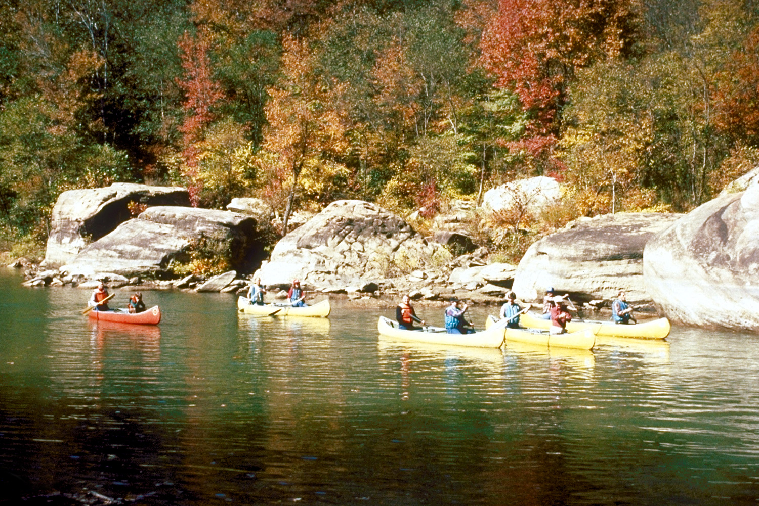
Caney Fork River — Infobox River river name = Caney Fork caption = Canoeing on the Caney Fork River near its headwaters in Cumberland County, Tennessee origin = Cumberland Plateau in Cumberland County, Tennessee mouth = Cumberland River basin countries = United… … Wikipedia
Caney Fork River — ▪ river, United States river formed by the confluence of the Collins and Rocky rivers in central Tennessee, U.S. It flows for 144 miles (232 km) in a northwesterly direction to the Cumberland River, near Carthage, in Smith county. On the… … Universalium
Caney Fork — Des canoës sur la rivière Caney Fork. Bassin versant de la rivière Caney Fork … Wikipédia en Français
River Roe — Roe River Roe River Caractéristiques Longueur 0,061 km Bassin ? Bassin collecteur … Wikipédia en Français
River Des Peres — Des Pères (rivière) Des Pères Caractéristiques Longueur 20 km Bassin ? Bassin collecteur … Wikipédia en Français
Calfkiller River — The Calfkiller River rises on the Cumberland Plateau of Tennessee just south of Interstate 40 near the town of Monterey in Putnam County. Several of the tributaries which coalesce to form the stream are impounded, including one which forms… … Wikipedia
Rocky River (Tennessee) — The Rocky River rises on the Cumberland Plateau in Van Buren County, Tennessee near the community of Chalaybeate. Entering a steep cove, it receives some suraface tributary water and more from large springs along its course. Shortly south of… … Wikipedia
Falling Water River — The Falling Water River is a stream located in the east central portion of Middle Tennessee. It rises in Putnam County in a dissected portion of the Cumberland Plateau. The stream descends rather steeply and is crossed by Interstate 40. Just… … Wikipedia
Cumberland River — River, Kentucky and Tennessee, U.S. It rises in southeastern Kentucky and flows west, looping through northern Tennessee before returning north to join the Ohio River after a course of 687 mi (1,106 km). It drops 92 ft (28 m) at Cumberland (or… … Universalium
Collins River — The Collins River is a 67 mile long (108 km)[1] tributary of the Caney Fork of the Cumberland River in the U.S. state of Tennessee. Via the Cumberland and Ohio rivers, it is part of the Mississippi River watershed. It rises on the Cumberland … Wikipedia


 Tennessee
 États-Unis