Caney Fork

Caney Fork
Caney Fork
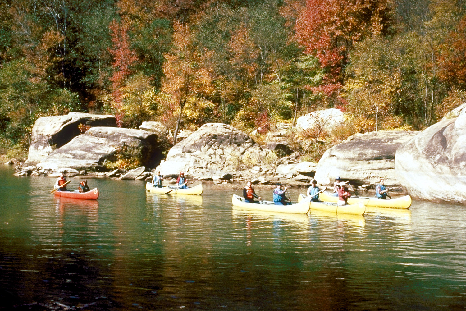
Des canoës sur la rivière Caney Fork.
Caney Fork Watershed Map.png

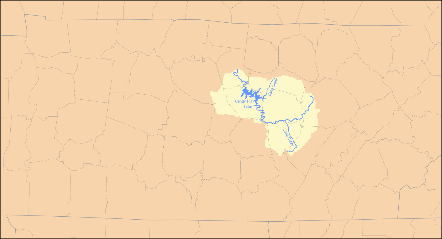
Bassin versant de la rivière Caney Fork.
Caractéristiques
Longueur 232 km
Bassin 4 587 km2
Bassin collecteur Mississippi
Débit moyen  ?
Cours
Source à environ 10 kilomètres à l'ouest de Crossville
Confluence Cumberland
 · Localisation en face de la ville de Carthage
Géographie
Pays traversés Tennessee Tennessee
Drapeau des États-Unis États-Unis

La Caney Fork ((en) Caney Fork River) est une rivière des États-Unis, affluent de la rivière Cumberland et qui fait partie du bassin du fleuve Mississippi par l'Ohio.

Sommaire

Parcours

La rivière prend sa source dans le comté de Cumberland à environ 10 kilomètres à l'ouest de Crossville, au centre de l'État du Tennessee. Le barrage Great Falls a créé un grand lac de barrage sur la rivière au niveau du comté de DeKalb. La rivière s'écoule ensuite vers le nord-ouest pour se jeter dans la rivière Cumberland en face de la ville de Carthage, siège du comté de Smith.

Principaux affluents

  • Calfkiller
  • Collins
  • Rocky

Liens externes

Notes et références


Wikimedia Foundation. 2010.

Contenu soumis à la licence CC-BY-SA. Source : Article Caney Fork de Wikipédia en français (auteurs)

Игры ⚽ Поможем сделать НИР

Regardez d'autres dictionnaires:

  • Caney Fork River — Caney Fork Caney Fork Des canoës sur la rivière Caney Fork …   Wikipédia en Français

  • Caney Fork River — Infobox River river name = Caney Fork caption = Canoeing on the Caney Fork River near its headwaters in Cumberland County, Tennessee origin = Cumberland Plateau in Cumberland County, Tennessee mouth = Cumberland River basin countries = United… …   Wikipedia

  • Municipio de Caney Fork (condado de Jackson, Carolina del Norte) — Caney Fork Municipio de los Estados Unidos …   Wikipedia Español

  • Caney Fork River — ▪ river, United States       river formed by the confluence of the Collins and Rocky rivers in central Tennessee, U.S. It flows for 144 miles (232 km) in a northwesterly direction to the Cumberland River, near Carthage, in Smith county. On the… …   Universalium

  • Clarks Fork Yellowstone river — Clarks Fork Yellowstone Clarks Fork Yellowstone Map of Montana rivers showing Clarks Fork Yellowstone River in south Caractéristiques …   Wikipédia en Français

  • Clarks Fork Yellowstone — Map of Montana rivers showing Clarks Fork Yellowstone River in south …   Wikipédia en Français

  • Lake Fork (Texas) — Infobox lake lake name = Lake Fork image lake = caption lake = image bathymetry = caption bathymetry = location = Northeast Texas coords = type = inflow = Lake Fork Creek, Big Caney, Little Caney outflow = catchment = 493 square miles (1277 km²)… …   Wikipedia

  • CFWR — Caney Fork and Western Railroad (Regional » Railroads) …   Abbreviations dictionary

  • Rock Island State Park (Tennessee) — Rock Island State Park is a state park in Warren County and White County, Tennessee, located in the Southeastern United States. The park is centered around Rock Island mdash; which is actually a peninsula created by the confluence of the Caney… …   Wikipedia

  • Scott's Gulf — is a canyon situated along the Caney Fork River in White County, Tennessee, located in the Southeastern United States. The canyon stretches for approximately convert|18|mi|km as the Caney Fork drops from the top of the Cumberland Plateau down to… …   Wikipedia

Share the article and excerpts

Direct link
Do a right-click on the link above
and select “Copy Link”