Amstelhoek
Contenu soumis à la licence CC-BY-SA. Source : Article Amstelhoek de Wikipédia en français (auteurs)
Regardez d'autres dictionnaires:
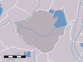
Amstelhoek — Dutch town locator maps mun town caption = The statistical district Amstelhoek en Amstelkade within the municipality De Ronde Venen.Amstelhoek (coord|52|13|N|4|56|E|type:city(55)) is a village in the Dutch province of Utrecht. It is located in… … Wikipedia
De Amstelhoek — (Мейдрехт,Нидерланды) Категория отеля: Адрес: Westzijde 10, 1426 AR Мейдрехт, Нидерла … Каталог отелей
De Ronde Venen — Municipality Vinkeveen … Wikipedia
List of places in the Netherlands — This is an alphabetical list of places (cities, towns, villages) in the Netherlands. Lists per province can be found at:* List of towns in Groningen * List of towns in Friesland * List of towns in Drente * List of towns in Overijssel * List of… … Wikipedia
Mijdrecht — Coordinates: 52°12′26″N 4°51′34″E / … Wikipedia
De Ronde Venen — Gemeinde De Ronde Venen Flagge Wappen Provinz Utrecht … Deutsch Wikipedia
Abcoude — 52°16′12″N 4°58′30″E / 52.27, 4.975 … Wikipédia en Français
Amstel-Drechtkanaal — Canal de l Amstel au Drecht Canal de l Amstel au Drecht Amstel Drechtkanaal Caractéristiques Longueur 18,5 km Histoire Géographie Début confluent Drecht et Canal de l Aar près Nieuwveen … Wikipédia en Français
Baambrugge — 52°14′46″N 4°59′19″E / 52.24611, 4.98861 … Wikipédia en Français
Baambrugse Zuwe — 52°13′45″N 4°57′5″E / 52.22917, 4.95139 … Wikipédia en Français
 Pays-Bas