- Kresevo
-
Kreševo
Kreševo
Крешево[[Image:|100px|center|Blason]] [[Image:|100px|center|Drapeau]] Blason Drapeau 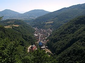
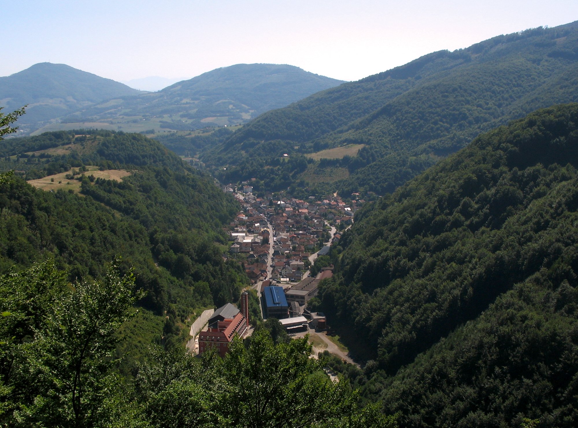
Vue générale de Kreševo Latitude
LongitudePays  Bosnie-Herzégovine
Entité Fédération de Bosnie-et-Herzégovine Région Canton Bosnie centrale Municipalité Kreševo Code Postal 71 260 Altitude 640 m Superficie Population (1991) 1 433 hab. Densité de population Erreur d’expression : opérateur round inattendu hab/km2 Gentilité Maire
Mandat en coursMato Barišić (HDZ-BiH)
2008-2012Divers Site Web [http:// ] Municipalité de Kreševo Superficie 149 km2 Population (1991) 6 731 hab. Densité de population 45,2 hab/km2 Maire
Mandat en coursMato Barišić (HDZ-BiH)
2008-2012Site Web Site de la municipalité Géolocalisation sur la carte de l'Europe

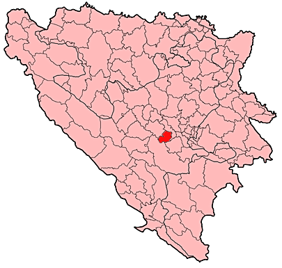
Géolocalisation sur la carte de Bosnie-Herzégovine
modifier 
Kreševo (en serbe cyrillique : Крешево) est une ville et une municipalité de Bosnie-Herzégovine. Elles sont situées dans le canton de Bosnie centrale, Fédération de Bosnie-et-Herzégovine. Au recensement 1991, la ville comptait 1 433 habitants et la municipalité 6 731[1]. En 2009, la population de la ville était estimée à 2 005 habitants[2].
Sommaire
Géographie
La municipalité de Kreševo est située dans une région de moyenne montagne, située à l'ouest de Sarajevo. Environ 90` % du territoire municipal est boisé. La ville de Kreševo, quant à elle, se trouve à environ 12 km au sud de Kiseljak.
Histoire
Localités
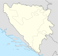
 Localisation de la municipalité de Kreševo en Bosnie-Herzégovine
En 1991, la municipalité de Kreševo comptait 27 localités :
- Alagići
- Bjelovići
- Botunja
- Bukva
- Crkvenjak
- Crnički Kamenik
- Crnići
- Deževice
- Drežnice
- Gunjani
- Kojsina
- Komari
- Kreševo
- Kreševski Kamenik
- Lipa
- Mratinići
- Pirin
- Poljani
- Polje
- Rakova Noga
- Ratkovići
- Stojčići
- Vidosovići
- Vodovoji
- Volujak
- Vranci
- Zvizd
Démographie
Ville
Répartition de la population dans la ville (1991)
Nationalité Nombre % Croates 937 65,38 Musulmans 305 21,28 Yougoslaves 126 8,79 Serbes 15 1,04 Inconnus/Autres 50 3,51 Municipalité
Évolution historique de la population dans la municipalité
Évolution démographique 1971 1981 1991 6 941 6 766 6 731 Répartition de la population dans la municipalité (1991)
En 1991, sur un total de 6 731 habitants, la population se répartissait de la manière suivante[1] :
Nationalité Nombre % Croates 4 714 70,03 Musulmans 1 531 22,74 Yougoslaves 251 3,72 Serbes 34 0,50 Inconnus/Autres 201 3,01 Politique
Sport
Kreševo possède un club de football, le NK Kreševo-Stanić.
Économie
Notes et références
- ↑ a et b (bs)(hr)(sr)[pdf] Recensement par communautés locales sur http://www.fzs.ba, Bosnie-Herzégovine - Fédération de Bosnie-et-Herzégovine - Institut fédéral de statistique. Consulté le 11 septembre 2009
- ↑ (fr) Kreševo sur http://gazetteer.de, World Gazetteer. Consulté le 14 septembre 2009
Voir aussi
Articles connexes
Liens externes
Villes de Bosnie-Herzégovine 
Banja Luka • Bihać • Bijeljina • Bosanska Dubica • Bosanska Gradiška • Bosanska Krupa • Bosanski Šamac • Brčko • Bugojno • Cazin • Čapljina • Derventa • Doboj • Foča • Gračanica • Gradačac • Ilidža • Kakanj • Livno • Lukavac • Ljubuški • Modriča • Mostar • Neum • Pale • Posušje • Prijedor • Sanski Most • Sarajevo • Srebrenica • Stolac • Široki Brijeg • Teslić • Tešanj • Tomislavgrad • Travnik • Trebinje • Tuzla • Velika Kladuša • Visoko • Višegrad • Zavidovići • Zenica • Zvornik • Živinice  Portail de la Bosnie-Herzégovine
Catégories : Ville de Bosnie-Herzégovine | Municipalité de Bosnie-Herzégovine | Localité de Bosnie-Herzégovine à majorité croate

Wikimedia Foundation. 2010.