Kings Highway
- Kings Highway
-
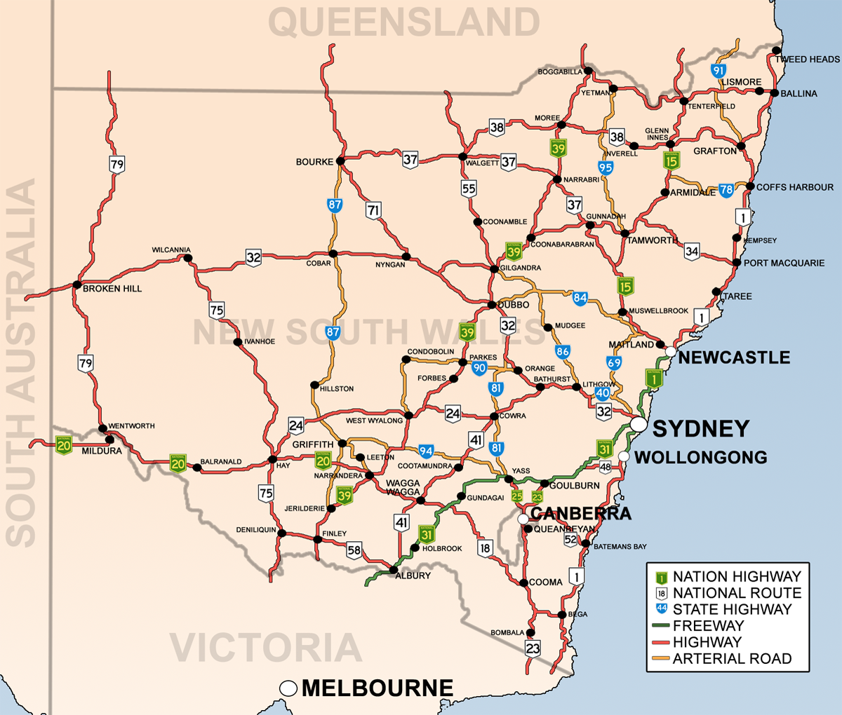
Carte routière de Nouvelle-Galles du Sud. La Kings Highway est la nationale 52
La Kings Highway ou King's Highway (National Road 52) est un axe routier situé en Nouvelle-Galles du Sud et sur le Territoire de la capitale australienne en Australie. Longue de 134 km et grossièrement orientée est-ouest, elle relie Canberra à Batemans Bay.
Elle démarre de la Monaro Highway à Fyshwick, un quartier de Canberra. Elle traverse la Molonglo River près de Queanbeyan, elle s'oriente d'abord vers le nord-ouest pour traverser les Southern Tablelands avant de s'orienter vers le sud-ouest.
A deux voies sur presque tout son parcours, elle présente un certain nombre de zones de doublement.
Catégories :
- Route de Nouvelle-Galles du Sud
- Route du Territoire de la capitale australienne
Wikimedia Foundation.
2010.
Contenu soumis à la licence CC-BY-SA. Source : Article Kings Highway de Wikipédia en français (auteurs)
Regardez d'autres dictionnaires:
Kings Highway — Geographische Lage Der Kings Highway ist eine Fernverkehrsstraße im australischen Bundesstaat New South Wales und im Australian Capital Territory. Er beginnt am Capital Hill in der Hauptstadt Canberra und führt über Queanbeyan in südöstlicher… … Deutsch Wikipedia
Kings Highway (Brooklyn) — Kings Highway is an avenue runs through the New York City borough of Brooklyn. The street has over 100 stores and shops. The west end is at Bay Parkway and 78th street. After intersecting with Ocean Avenue the street becomes mostly residential,… … Wikipedia
Kings Highway (línea Brighton) — Kings Highway … Wikipedia Español
Kings Highway (línea Culver) — Kings Highway Estación del Metro de Nueva York … Wikipedia Español
Kings Highway (línea Sea Beach) — Kings Highway Estación del Metro de Nueva York … Wikipedia Español
Kings Highway Bridge — is located on the Nansemond River in the independent city of Suffolk, Virginia, United States. Built in 1928, for many years, it carried traffic on the Kings Highway, also known as State Route 125 for over 75 years. The drawbridge, opened in 1928 … Wikipedia
Kings Highway (New York City Subway) — Kings Highway is the name of three stations of the New York City Subway:*Kings Highway (NYCS Brighton) on the BMT Brighton Line *Kings Highway (NYCS Culver BMT) on the BMT Culver Line *Kings Highway (NYCS Sea Beach local) on the BMT Sea Beach… … Wikipedia
Kings Highway, Australia — Infobox Australian Road road name = Kings Highway type = route route route photo = KingsHighwayClydeMntn20050627.jpg caption = Climbing Clyde Mountain from the coast to Braidwood length = 150 direction = West East start = finish = est = 1974… … Wikipedia
Kings Highway (BMT Brighton Line) — Infobox NYCS name = Kings Highway font color = black bg color = #FFC800 bg color 2 = #FF6E1A line = BMT Brighton Line service = Brighton platforms = 2 island platforms tracks = 4 borough = Brooklyn open date = original station: July 2, 1878… … Wikipedia
Kings Highway (IND Culver Line) — Infobox NYCS name = Kings Highway bg color = #FF6E1A line = IND Culver Line service = Culver BMT platforms = 2 island platforms tracks = 3 borough = Brooklyn open date = March 16, 1919 north line = IND Culver Line north local station = Avenue P… … Wikipedia