Khao Luang
- Khao Luang
-
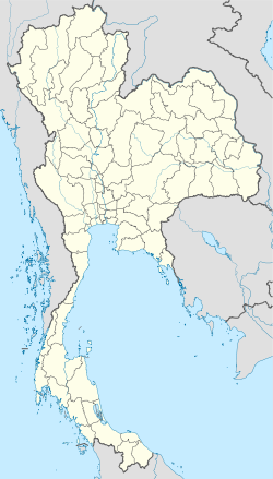
Le Khao Lang (1 835 m d'altitude) est le point culminant de la région péninsulaire de la Thaïlande.
Il a donné son nom à un parc national couvrant une superficie de 570 kilomètres carrés et constitué en grande partie de terrains montagneux et d’orchidées luxuriantes. Cet endroit est réputé pour ses chutes d’eau spectaculaires.
Catégories :
- Sommet d'Asie
- Montagne de Thaïlande
- Point culminant
- Ligne de partage des eaux entre océan Indien et océan Pacifique
Wikimedia Foundation.
2010.
Contenu soumis à la licence CC-BY-SA. Source : Article Khao Luang de Wikipédia en français (auteurs)
Regardez d'autres dictionnaires:
Khao Luang — Naional Park is located on the southern peninsula of Thailand in Nakhon Sri Thammarat province. It is named after the tallest mountain in the park which is also the tallest in southern Thailand. The park is mountainous with many tall mountains… … Wikipedia
Nationalpark Khao Luang — Nationalpark Khao Luang … Deutsch Wikipedia
Amphoe Thung Khao Luang — Thung Khao Luang ทุ่งเขาหลวง Provinz: Roi Et Fläche: 138,9 km² Einwohner: 24.260 (2005) Bev.dichte: 174,7 E./km² PLZ: 451 … Deutsch Wikipedia
Amphoe Thung Khao Luang — Infobox Amphoe name=Thung Khao Luang thai=ทุ่งเขาหลวง province=Roi Et coordinates=coord|15|59|32|N|103|51|33|E|type:adm2nd region:TH capital=Thung Khao Luang area=138.9 population=24,260 population as of=2005 density=174.7 postal code=45170… … Wikipedia
Thung Khao Luang — Original name in latin Thung Khao Luang Name in other language Amphoe Thung Khao Luang, King Amphoe Thung Khao Luang, Thung Khao Luang, thung khea hlwng State code TH Continent/City Asia/Bangkok longitude 15.99397 latitude 103.86264 altitude 131… … Cities with a population over 1000 database
Amphoe Thung Khao Luang — Admin ASC 2 Code Orig. name Amphoe Thung Khao Luang Country and Admin Code TH.25.7510809 TH … World countries Adminstrative division ASC I-II
Khao Sam Roi Yot — Hafen von Bang Pu … Deutsch Wikipedia
Khao Sok — Nationalpark Khao Sok Rachabrapha Stausee … Deutsch Wikipedia
Luang Prabang — Luang Prabang … Wikipedia Español
Khao Yoi — เขาย้อย Provinz: Phetchaburi Fläche: 305,648 km² Einwohner: 35,868 (2000) Bev.dichte: 117,4 E./km² PLZ: 76140 … Deutsch Wikipedia

 Thaïlande