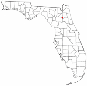
Keystone Heights
Contenu soumis à la licence CC-BY-SA. Source : Article Keystone Heights de Wikipédia en français (auteurs)
Regardez d'autres dictionnaires:
Keystone Heights — Ciudad de los Estados Unidos … Wikipedia Español
Keystone Heights — Keystone Heights … Deutsch Wikipedia
Keystone Heights — Keystone Heights, FL U.S. city in Florida Population (2000): 1349 Housing Units (2000): 562 Land area (2000): 4.544004 sq. miles (11.768916 sq. km) Water area (2000): 0.085131 sq. miles (0.220487 sq. km) Total area (2000): 4.629135 sq. miles… … StarDict's U.S. Gazetteer Places
Keystone Heights, FL — U.S. city in Florida Population (2000): 1349 Housing Units (2000): 562 Land area (2000): 4.544004 sq. miles (11.768916 sq. km) Water area (2000): 0.085131 sq. miles (0.220487 sq. km) Total area (2000): 4.629135 sq. miles (11.989403 sq. km) FIPS… … StarDict's U.S. Gazetteer Places
Keystone Heights — Original name in latin Keystone Heights Name in other language State code US Continent/City America/New York longitude 29.78608 latitude 82.03149 altitude 45 Population 1350 Date 2011 05 14 … Cities with a population over 1000 database
Keystone Heights Junior/Senior High School — Infobox School name = Keystone Heights Junior/Senior High School imagesize = caption = location = streetaddress = 900 SW Orchid Avenue region = city = Keystone Heights state = Florida district = Clay County School District province = county =… … Wikipedia
Keystone Heights, Florida — Infobox Settlement official name = Keystone Heights, Florida other name = native name = nickname = settlement type = City motto = imagesize = image caption = flag size = image seal size = image shield = shield size = image blank emblem = blank… … Wikipedia
Keystone Heights Airport — is a public airport located two miles (3 km) north of Keystone Heights, Florida.The airport is adjacent to Camp Blanding, the Florida National Guard Reservation and Fly through History Military Museum and Memorial Park. This museum is dedicated… … Wikipedia
Keystone High School — may refer to:*Keystone Charter School mdash; Sandy Valley, Nevada * Keystone High School mdash; LaGrange, Ohio *Keystone Oaks High School mdash; Pittsburgh, Pennsylvania *Keystone Job Corp High School mdash; Drums, Pennsylvania *Keystone… … Wikipedia
Keystone — may refer to:* Keystone (architecture), the piece at the apex of an arch or vault * The Keystone effect, caused by projecting an image onto a surface at an angle, or by photography at an angle * Keystone correction for these types of… … Wikipedia
 Pour les articles homonymes, voir Keystone (homonymie).
 États-Unis
 Floride


