Kakogawa
- Kakogawa
-
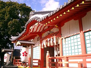
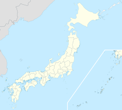
Kakogawa (加古川市, Kakogawa-shi?) est une ville située dans la préfecture de Hyōgo au Japon.
En 2010, la ville avait une population de 268 565 habitants pour une densité de 1 939 hab/km². La superficie totale de la ville est de 138,51 km².
La ville a été fondée le 15 juin 1950.
Les symboles de la ville sont le pin et le rhododendron.
Kakogawa produit dans le secteur textile (chaussettes et serviettes).
Kakogawa est desservie par les routes :
- 国道2号 (route nationale 2)
- 国道250号 (route nationale 250)
Lien externe
Wikimedia Foundation.
2010.
Contenu soumis à la licence CC-BY-SA. Source : Article Kakogawa de Wikipédia en français (auteurs)
Regardez d'autres dictionnaires:
Kakogawa — shi 加古川市 Geographische Lage in Japan … Deutsch Wikipedia
Kakogawa — Kakogawa, Stadt auf Honshū, Japan, in der Himejiebene, 239 800 Einwohner; Textil , Leder , Metallindustrie, Kautschukverarbeitung, Kunstdüngerherstellung … Universal-Lexikon
Kakogawa — Original name in latin Kakogawa Name in other language Kakogawa, gakogawa si, jia gu chuan shi State code JP Continent/City Asia/Tokyo longitude 34.76667 latitude 134.85 altitude 7 Population 271634 Date 2012 01 19 … Cities with a population over 1000 database
Kakogawa — Ka·ko·ga·wa (kä kô gäʹwə) A city of southern Honshu, Japan, west of Kobe. It is an industrial center. Population: 249,390. * * * ▪ Japan city in Hyōgo ken (prefecture), Honshu, Japan. It lies in the lower valley of the Kako River. A… … Universalium
Kakogawa, Hyōgo — Infobox City Japan Name= Kakogawa JapaneseName= 加古川市 Map Region= Kansai Prefecture= Hyōgo District= Area km2= 138.51 PopDate= January 2008 Population= 267,631 Density km2= 1930 Coords= LatitudeDegrees= 34 LatitudeMinutes= 45 LatitudeSeconds=… … Wikipedia
Kakogawa Line — The Nihongo|Kakogawa Line|加古川線|Kakogawa sen is a railway line in Hyōgo Prefecture, Japan operated by West Japan Railway Company (JR West) that connects the cities of Kakogawa and Tamba.The convert|48.5|km line begins at Kakogawa Station on the JR … Wikipedia
Kakogawa Station — is a train station in Kakogawa, Hyōgo Prefecture, Japan.Lines*West Japan Railway Company (JR West):*Sanyo Main Line (JR Kobe Line):*Kakogawa LineLayoutAdjacent stations !colspan=5|West Japan Railway Company (JR West) ###@@@KEYEND@@@### … Wikipedia
Kakogawa-shi — Admin ASC 2 Code Orig. name Kakogawa shi Country and Admin Code JP.13.1860702 JP … World countries Adminstrative division ASC I-II
Kakogawa — ► C. de Japón, en la isla de Hondo, prefectura de Hyogo; 239 803 h … Enciclopedia Universal
8892 Kakogawa — Infobox Planet minorplanet = yes width = 25em bgcolour = #FFFFC0 apsis = name = Kakogawa symbol = caption = discovery = yes discovery ref = discoverer = M. Sugano and T. Nomura discovery site = Minami Oda discovered = September 11, 1994… … Wikipedia