Kaghtsrashen

Kaghtsrashen

39° 58′ 00″ N 44° 37′ 00″ E / 39.966667, 44.616667

Kaghtsrashen
Քաղցրաշեն
Administration
Pays Drapeau d'Arménie Arménie
Région Ararat
Maire Valerik Gyulamiryan[1]
(2008)
Géographie
Coordonnées 39° 58′ 00″ Nord
       44° 37′ 00″ Est
/ 39.966667, 44.616667
Superficie 876 ha = 8,76 km2
Démographie
Population 3 088 hab.
Densité 352,5 hab./km2
Localisation
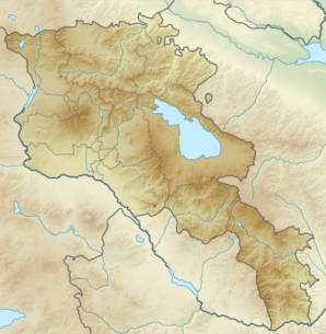
Voir la carte topographique
Kaghtsrashen
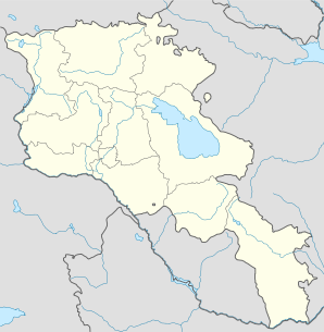
Voir la carte administrative
Kaghtsrashen

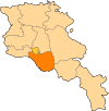
Kaghtsrashen (en arménien Քաղցրաշեն) est une communauté rurale du marz d'Ararat en Arménie. En 2008, elle compte 3 088 habitants[2].

Notes et références

  1. (hy+en) Central Electoral Commission of the Republic of Armenia. Consulté le 24 janvier 2011.
    Pour obtenir la page en anglais, cliquez sur le drapeau arménien en haut à gauche, et sélectionnez « English » ; ensuite, dans le menu vertical de gauche, cliquez sur « Local », sélectionnez le marz pertinent, puis la dernière élection correspondant à la communauté voulue.
  2. (en) ArmStat, Marzes of the Republic of Armenia in figures, 2008, « RA Ararat Marz », 2008. Consulté le 25 juillet 2009.

Wikimedia Foundation. 2010.

Contenu soumis à la licence CC-BY-SA. Source : Article Kaghtsrashen de Wikipédia en français (auteurs)

Игры ⚽ Поможем написать курсовую

Regardez d'autres dictionnaires:

  • Kaghtsrashen — Infobox Settlement official name =Kaghtsrashen Քաղցրաշեն native name = pushpin mapsize =150px subdivision type = Country subdivision name = Armenia subdivision type1 = Marz (Province) subdivision name1 =Ararat leader title = leader name =… …   Wikipedia

  • Yerevan — For other uses, see Yerevan (disambiguation). Coordinates: 40°11′00″N 44°31′00″E …   Wikipedia

  • Ararat, Armenia — Ararat Արարատ …   Wikipedia

  • Nor Hachn — Coordinates: 40°18′07″N 44°34′59″E / 40.30194°N 44.58306°E / 40.30194; 44.58306 …   Wikipedia

  • Arevshat — For the place in Shirak province, see Arevshat, Shirak; for the village in Azerbaijan, see Dolanlar. Coordinates: 40°02′21″N 44°32′30″E / 40.03917°N 44.54167°E …   Wikipedia

  • Aygezard — Coordinates: 39°56′45″N 44°36′32″E / 39.94583°N 44.60889°E / 39.94583; 44.60889 …   Wikipedia

  • Azatavan — For the place in Armavir province, see Azatavan, Armavir. Coordinates: 39°59′N 44°30′E / 39.983°N 44.5°E / 39.983; 44.5 …   Wikipedia

  • Hovtashat — Հովտաշատ …   Wikipedia

  • Marmarashen — Not to be confused with Marmashen. Marmarashen Մարմարաշեն Nor Kyurin (foreground), Marmarashen (background with unfinished church), and Mt. Ararat, May 2009 …   Wikipedia

  • Mkhchyan — Մխչյան …   Wikipedia

Share the article and excerpts

Direct link
Do a right-click on the link above
and select “Copy Link”