Jindera
Contenu soumis à la licence CC-BY-SA. Source : Article Jindera de Wikipédia en français (auteurs)
Regardez d'autres dictionnaires:
Jindera — Original name in latin Jindera Name in other language Dzhindera, Jindera, Джиндера State code AU Continent/City Australia/Sydney longitude 35.95474 latitude 146.88852 altitude 233 Population 1623 Date 2012 02 28 … Cities with a population over 1000 database
Jindera, New South Wales — Infobox Australian Place | type = town name = Jindera state = nsw caption = Jindera looking south in the main street lga = postcode = 2642 pop = 956 (2001 census) est = elevation= 304 maxtemp = 20.5 mintemp = 7.8 rainfall = county = Goulburn… … Wikipedia
German settlements in the Riverina — In Australia, a number of German settlements in the Riverina were established in the late nineteenth century. The settlements were populated by Germans migrating both from established German settlements in South Australia and directly from… … Wikipedia
Hume Football League — The Hume Football League is an Australian rules football competition in the southern Riverina region of New South Wales, with clubs coming from a number of farming communities. Some players also come from the city of Albury, which is at the south … Wikipedia
Goulburn County — Map of all coordinates from Google Map of all coordinates from Bing Export all coordinates as KML … Wikipedia
Olympic Highway — For the Olympic Highway in the U.S. state of Washington, see U.S. Route 101 in Washington. Olympic Highway Proposed to replace … Wikipedia
Riverina — Note Eardley in turn relies on Hope, J. (1995) Aboriginal Burial Conservation in the Murray Darling Basin. Historic Environment . Vol. 11(2 3), p. 57 60. for section 5.4 Settlement and Land Use (page 22) which covers Aboriginal settlement. ] The… … Wikipedia
List of Lutheran schools in Australia — Lutheran schools are educational institutions set up under or affiliated to the Lutheran Church of Australia. These schools must be accredited by the relevant State Government authorities in Australia under the various education laws in place.… … Wikipedia
Morven, New South Wales — Morven New South Wales Entering Village of Morven … Wikipedia
Table Top/Ettamogah, New South Wales — Infobox Australian Place | type = suburb name = Table Top/Ettamogah city = Albury state = nsw caption = Table Top Mountain lga = City of Albury postcode = 2640 est = pop = 1179 pop footnotes = area = propval = stategov = Albury fedgov = Farrer… … Wikipedia
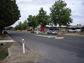 La grand'rue de Jindera
 Australie
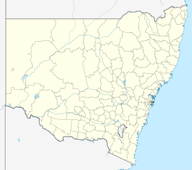
 Jindera


