Irebu

Irebu

0° 37′ 00″ S 17° 45′ 00″ E / -0.616666, 17.750000

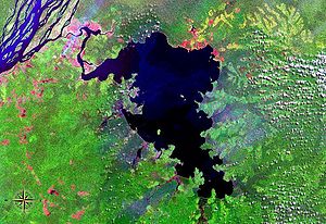
Photo satellite du lac Tumba avec Irebu au bord du fleuve Congo

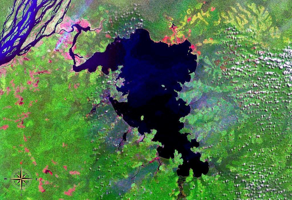
Irebu est une localité du territoire de Bikoro (Équateur) en République démocratique du Congo. Elle borde le fleuve Congo là où le lac Tumba est relié au fleuve, à 20 km de là où l'Ubangi se joint au fleuve.

Selon la tradition orale, Irebu a été fondée par Ekanda. Les habitants d'Irebu ont commencé à faire du commerce avec les Bobangi et obtenu les mêmes droits qu'eux, mais suite à un conflit d'intérêt, ces deux groupes se sont séparés et Irebu a perdu ses droits de commerces sur le sud du Moyen-Congo jusqu'au Pool Malebo. Irebu a ensuite continué le commerce avec le nord du fleuve Congo. [1]

En 1905, Irebu est une station sur le fleuve, entre Coquilhatville (Mbandaka) et Lukolela.

Liens externes

Références

  1. Oral Tradition and Ethnicity, Robert Harms, Journal of Interdisciplinary History, Vol. 10, No. 1 (Summer, 1979), pp. 61-85

Wikimedia Foundation. 2010.

Contenu soumis à la licence CC-BY-SA. Source : Article Irebu de Wikipédia en français (auteurs)

Игры ⚽ Нужно сделать НИР?

Regardez d'autres dictionnaires:

  • Bobangi — Bobangis  Ne doit pas être confondu avec Bangala. Bobangis Populations significatives par régions …   Wikipédia en Français

  • Bobangis —  Ne doit pas être confondu avec Bangala ni Bangi. Bobangis Populations Autre Langue(s) bobangi, lingala …   Wikipédia en Français

  • Lac Tumba — Lac Ntumba Photo satellite du lac Tumba Administration Pays …   Wikipédia en Français

  • Ngala — Bobangis  Ne doit pas être confondu avec Bangala. Bobangis Populations significatives par régions …   Wikipédia en Français

  • Ubangi River — River, central Africa. Formed by the Bomu River and the Uele River on the northern border of the Democratic Republic of the Congo, it flows west and south, forming part of the boundary with the Central African Republic and with the Republic of… …   Universalium

  • Tumbasee — NASA Aufnahme des Tumbasees Geographische Lage Nordwesten der Demokratischen Republik Kongo Abfluss Irebu Kanal → Kongo …   Deutsch Wikipedia

  • Transport in the Democratic Republic of the Congo — Diagrammatic Map of ground and water transport in the DR Congo in 2000 (roads) and 2006 (waterways and railways) Ground transport in the Democratic Republic of Congo (DRC) has always been difficult. The terrain and climate of the Congo Basin… …   Wikipedia

  • Equateur (district) — Équateur (district) Pour les articles homonymes, voir Équateur. District de l Équateur …   Wikipédia en Français

  • Équateur (district) — Pour les articles homonymes, voir Équateur. District de l Équateur Localisation du district de l Équateur Informati …   Wikipédia en Français

  • Tumba, Lake — ▪ lake, Democratic Republic of the Congo       lake, part of the Congo River basin, northwestern Congo (Kinshasa). Lake Tumba lies 75 miles (120 km) northwest of Lake Mai Ndombe (formerly Lake Léopold II). It covers 190 square miles (500 square… …   Universalium

Share the article and excerpts

Direct link
Do a right-click on the link above
and select “Copy Link”