Inverkeithing
Contenu soumis à la licence CC-BY-SA. Source : Article Inverkeithing de Wikipédia en français (auteurs)
Regardez d'autres dictionnaires:
Inverkeithing — is a town and former royal burgh in Fife, Scotland, located on the Firth of Forth. The port town was given burgh status by King David I of Scotland (1124 53) in the 12th century and is situated about 9 miles (15 km) north from Edinburgh Airport… … Wikipedia
Inverkeithing — Koordinaten 56° 2′ N, 3° 24′ W … Deutsch Wikipedia
Inverkeithing — INVERKEITHING, a parish, sea port, burgh, and market town, in the district of Dunfermline, county of Fife, 12½ miles (N. W. by W.) from Edinburgh; containing, with the village of Hillend, 2530 inhabitants, of whom 1674 are in the burgh. This… … A Topographical dictionary of Scotland
Inverkeithing — (spr. Inverkiddhing), Marktflecken der schottischen Grafschaft Fife; am Frith of Forth, Hafen, Quarantainehaus; Kohlen u. Salzwerke; 2800 Ew … Pierer's Universal-Lexikon
Inverkeithing — Original name in latin Inverkeithing Name in other language Inverkeithing State code GB Continent/City Europe/London longitude 56.03297 latitude 3.39555 altitude 20 Population 5163 Date 2011 01 06 … Cities with a population over 1000 database
Inverkeithing High School — Infobox School name = Inverkeithing High School song = Chelsea Dagger Fratellis playground = concrete/grass streetaddress = IHS, Hillend Road, Inverkeithing, KY11 1PL city = Inverkeithing county = Fife postcode = KY11 1PL country = Scotland… … Wikipedia
Inverkeithing railway station — Infobox UK station name = Inverkeithing code = INK caption = Looking north towards the station manager = First ScotRail locale = Inverkeithing borough = Fife usage0405 = 0.988 usage0506 = 0.972 usage0607 = 0.986 platforms = 2 years = 1890 events … Wikipedia
Battle of Inverkeithing — Infobox Military Conflict conflict=Battle of Inverkeithing caption= partof=Scottish Civil War date=July 20, 1651 place=Inverkeithing, Scotland result=Decisive English Parliamentarian victory combatant1=Scottish Army supporters of Charles II… … Wikipedia
Bataille De Inverkeithing — La bataille de Inverkeithing (20 juillet 1651, à Inverkeithing en Écosse) est la dernière bataille de la Troisième guerre civile anglaise. Les troupes parlementaires de la New Model Army commandées par John Lambert remportent la victoire sur l… … Wikipédia en Français
Bataille de Inverkeithing — La bataille de Inverkeithing (20 juillet 1651, à Inverkeithing en Écosse) est la dernière bataille de la Troisième guerre civile anglaise. Les troupes parlementaires de la New Model Army commandées par John Lambert remportent la victoire sur l… … Wikipédia en Français
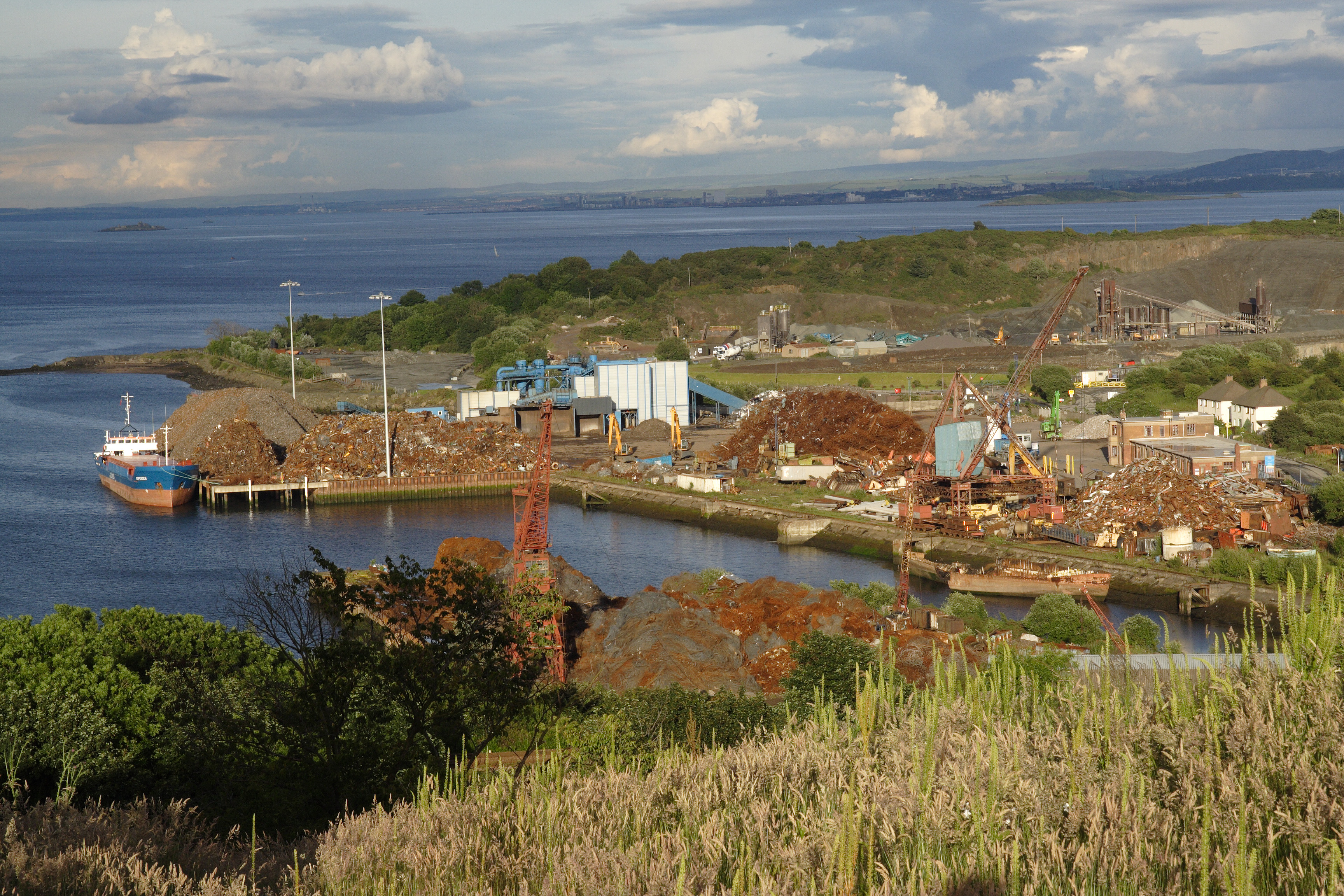
 Le port d'Inverkeithing
 Portail de l’Écosse
 Portail du monde maritime