Ickleford
- Ickleford
-
51°58′13″N 0°17′1″O / 51.97028, -0.28361
Ickleford est un village du Hertfordshire, en Angleterre. Il est situé sur la rivière Hiz, à 2 km au nord de Hitchin, et compte environ 2 000 habitants.
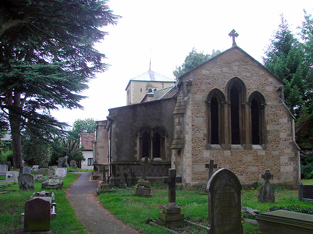
Le village possède une église du XIIe siècle dédiée à sainte Catherine. Il est traversé par l'ancienne voie romaine d'Icknield Way. Il y a une école primaire, un bureau de poste, deux magasins et quatre pubs.
Lien externe
Sur les autres projets Wikimedia :
Catégories :
- Village du Hertfordshire
- Toponyme indiquant un gué
Wikimedia Foundation.
2010.
Contenu soumis à la licence CC-BY-SA. Source : Article Ickleford de Wikipédia en français (auteurs)
Regardez d'autres dictionnaires:
Ickleford — infobox UK place country = England latitude= 51.97036 longitude= 0.28368 official name= Ickleford population= 1,848 shire district= North Hertfordshire shire county = Hertfordshire region= East of England constituency westminster= post town=… … Wikipedia
Counties (Detached Parts) Act 1844 — The Counties (Detached Parts) Act 1844 Parliament of the United Kingdom Long title An Act to annex detached Parts of Counties to the Counties in which they are situated. Statute book ch … Wikipedia
King of the Gypsies — For the 1978 movie with the same title, see King of the Gypsies (film). The title King of the Gypsies has been claimed or given over the centuries to many different people. It is both culturally and geographically specific. It may be inherited,… … Wikipedia
High Sheriff of Hertfordshire — This is a list of High Sheriffs of Hertfordshire.William I, William II, Henry I, Stephen* Ibert * Peter de Valoignes * Edward de Saresburg * Geoffrey de Magnaville * Stephen * Alberie de Vere, Jun, and *1139 Richard Bassett, Justices of England * … Wikipedia
Icknield Way — bei Lewknor in Oxfordshire Der Icknield Way ist ein historischer Fußpfad in Süd England. Er liegt im ganzjährig trockenen Gebiet oberhalb der Wasserquellen auf der Kreide Schichtstufe der Berkshire Downs und Chiltern Hills Inhaltsverzeichn … Deutsch Wikipedia
Henry Bessemer — Sir Henry Bessemer (January 19, 1813–March 15, 1898), English engineer and inventor. Bessemer s name is chiefly known in connection with the Bessemer process for the manufacture of steel.Early lifeHenry Bessemer s father, Anthony, was born in… … Wikipedia
Icknield Way — Infobox Hiking trail Name=Icknield Way Photo=DSCN1960 ivinghoe beacon 1200x900.jpg Caption=Ivinghoe Beacon lies on the trail Location=East Anglia, England, United Kingdom Designation= Length=over Convert|100|mi|0 [… … Wikipedia
Hitchin — infobox UK place country = England latitude = 51.9476 longitude = 0.2832 official name = Hitchin static static image caption= Hitchin Market Place population = 30,360 shire district = North Hertfordshire shire county = Hertfordshire region = East … Wikipedia
North Hertfordshire — District Non metropolitan district North Hertfordshire shown within Hertfordshire … Wikipedia
List of places in Hertfordshire — This is a list of settlements in the ceremonial county of Hertfordshire, England. See the list of places in England for places in other counties.compactTOC NOTOC A*Abbots Langley, Adeyfield, Albury, Aldbury, Aldenham, Amwell, Apsley, Ashridge,… … Wikipedia
 L'église d'Ickleford.