Hrta
- Hrta
-
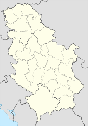
Hrta (en serbe cyrillique : Хрта) est un village de Serbie situé dans la municipalité de Prijepolje, district de Zlatibor. En 2002, il comptait 130 habitants[1], dont une majorité de Bosniaques.
Démographie
Évolution historique de la population
Évolution démographique
| 1948 |
1953 |
1961 |
1971 |
1981 |
1991 |
2002 |
| 336 |
384 |
409 |
436 |
348 |
238 |
130[1] |
Répartition de la population (2002)
Notes et références
- ↑ a et b (sr) Livre 9, Population, analyse comparative de la population en 1948, 1953, 1961, 1971, 1981, 1991 et 2002, données par localités, Institut de statistique de la République de Serbie, Belgrade, mai 2004 (ISBN 86-84433-14-9)
- ↑ (sr) Livre 1, Population, origine nationale ou ethnique, données par localités, Institut de statistique de la République de Serbie, Belgrade, février 2003 (ISBN 86-84433-00-9)
Voir aussi
Articles connexes
Liens externes
Catégories :
- Localité de Prijepolje
- Localité de Serbie à majorité bosniaque
Wikimedia Foundation.
2010.
Contenu soumis à la licence CC-BY-SA. Source : Article Hrta de Wikipédia en français (auteurs)
Regardez d'autres dictionnaires:
Hampton Roads Transportation Authority — (HRTA) is a political subdivision of the Commonwealth of Virginia in the United States that has the responsibility for funding several major traffic projects in the Hampton Roads area. As of March 2008, although its projects were considered to be … Wikipedia
Jordan Bridge — Norfolk Portsmouth Bridge redirects here. For the facility to the north, which consists of the Berkley Bridge and Downtown Tunnel, see Norfolk Portsmouth Bridge Tunnel. Jordan Bridge was a tolled highway lift bridge which carried State Route 337… … Wikipedia
Prijepolje — Пријепоље Héraldique … Wikipédia en Français
Hampton Roads — Coordinates: 36°58′N 76°22′W / 36.967°N 76.367°W / 36.967; 76.367 … Wikipedia
Proto-Indo-European religion — The chariot, as a symbol of social rank and military strength but also mythologically as the sun chariot (Trundholm sun chariot pictured, Nordic Bronze Age, ca. 160 … Wikipedia
Prijepolje — Infobox Serbia municipality native name = Пријепоље|official name=Prijepolje district = Zlatibor| image shield = Grb Prijepolje.jpg mayor = Nedžad Turković area km2 = 827 population total = 15031 | mpop=41188 latd = 43| latm = 32|longd = 19|… … Wikipedia
Hampton Roads Bridge-Tunnel — Infobox Bridge bridge name=Hampton Roads Bridge Tunnel locale=Norfolk, Virginia to Hampton, Virginia carries=4 lanes of I 64/US 60 crosses=Hampton Roads maint=Virginia Department of Transportation clearance=14 6 /4.42m (eastbound) 13 6 /4.11m… … Wikipedia
Hampton Roads Beltway — The Hampton Roads Beltway is a loop of Interstate 64 and Interstate 664, which links the communities of the Virginia Peninsula and South Hampton Roads which surround the body of water known as Hampton Roads and comprise much of the region of the… … Wikipedia
List of cities, towns and villages in Serbia — This is the complete list of settlements in Serbia without Kosovo, as recorded by 2002 census, sorted by municipalities. Settlements denoted as urban (towns and cities) are marked bold. Population for every settlement is given in brackets. The… … Wikipedia
List of settlements in Serbia (alphabetic) — This is the complete list of settlements in Serbia without Kosovo, as recorded by 2002 census, in alphabetic order. Settlements denoted as urban (towns and cities) are marked bold. Population for every settlement is given in brackets. The same… … Wikipedia
 Serbie
