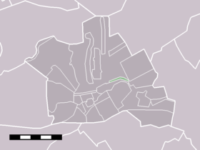
Houtdijken
Contenu soumis à la licence CC-BY-SA. Source : Article Houtdijken de Wikipédia en français (auteurs)
Regardez d'autres dictionnaires:
Houtdijken — Dutch town locator maps mun town caption = Houtdijken in the municipality of Woerden.Houtdijken (coord|52|6|N|4|56|E|type:city(50)) is a town in the Dutch province of Utrecht. It is a part of the municipality of Woerden, and lies about 4 km… … Wikipedia
Kamerik-Houtdijken — Ancienne commune des Pays Bas Histoire Administration Pays Pays B … Wikipédia en Français
Kamerik-Houtdijken — is a former municipality in the Dutch province of Utrecht. It existed from 1818 to 1857, after which it merged with s Gravesloot, Kamerik Mijzijde, and Teckop, to form the new municipality of Kamerik. [Ad van der Meer and Onno Boonstra,… … Wikipedia
's-Gravesloot — Ancienne commune des Pays Bas Histoire Administration Pays Pays Bas … Wikipédia en Français
Anciennes communes de la province d'Utrecht — En 1812, la province néerlandaise d Utrecht comptait 56 communes (contre 97 dès 1820). Depuis 2006, il n y en a plus que 29. Étapes principales des fusions : 1989 : L ouest de la province 1954 : Autour de la ville d Utrecht… … Wikipédia en Français
Kamerik — 52°6′39″N 4°53′34″E / 52.11083, 4.89278 … Wikipédia en Français
Kamerik-Mijzijde — Ancienne commune des Pays Bas Histoire Administration Pays Pays Bas … Wikipédia en Français
Teckop — 52°8′0″N 4°55′17″E / 52.13333, 4.92139 … Wikipédia en Français
Kamerik — Dutch town locator maps mun town caption = The village of Kamerik (dark green) and the statistical district Kamerik and Kanis (light green) in the municipality of Woerden.Kamerik (coord|52|7|N|4|54|E|type:city(2421)) is a town in the Dutch… … Wikipedia
Kamerik-Mijzijde — Mijzijde Hamlet Kamerik Mijzijde … Wikipedia
 Pays-Bas

