Horse Island (Summer Isles)
- Horse Island (Summer Isles)
-
Horse Island est une île du Royaume-Uni située en Écosse.
Wikimedia Foundation.
2010.
Contenu soumis à la licence CC-BY-SA. Source : Article Horse Island (Summer Isles) de Wikipédia en français (auteurs)
Regardez d'autres dictionnaires:
Horse Island, Summer Isles — Infobox Scottish island latitude=57.99 longitude= 5.34 GridReference=NC023045 celtic name= Eilean nam Eich norse name= meaning of name= area= 53 ha area rank= 188= highest elevation=Sgurr nan Uan 60 m Population=0 population rank= main settlement … Wikipedia
Horse Island — is the name of several places:Canada*Horse Islands (Newfoundland and Labrador), Canada *Horse Island (Lake Winnipeg), ManitobaFaroe Islands*Hestur, Faroe Islandscotland*Horse Isle in the Firth of Clyde, Scotland *Horse Island, Shetland in the… … Wikipedia
Summer Isles — Les Summer Isles vues vers le sud ouest depuis le Ben Mor Coigach : Tanera Mòr est la plus grande des îles sur la droite. Géographie … Wikipédia en Français
Summer Isles — infobox UK place country = Scotland official name= Summer Isles gaelic name= Na h Eileanan Samhraidh population= 5 (2001 Census) os grid reference= NB992067 latitude= 58.030338 longitude= 5.453436 map type=Scotland unitary scotland= Highlands… … Wikipedia
Summer Isles — Islas Summer (Na h Eileanan Samhraidh Summer Isles) Vista de las Summer Isles desde Ben Mor Coigach Localización geográfica / ad … Wikipedia Español
Horse Island — Cette page d’homonymie répertorie les différentes îles partageant un même nom. Horse Island peut désigner : Horse Island dans les Small Isles en Écosse ; Horse Island dans les Summer Isles en Écosse ; Horse Island dans le… … Wikipédia en Français
Northern Isles — This article is about the large group of Scottish islands including Orkney and Shetland. For the northern islands of Shetland, see North Isles. The Northern Isles of Scotland. The Northern Isles (Old Norse: Norðreyjar; Scots Gaelic: Na h Eileanan … Wikipedia
Îles Summer — Summer Isles (en) Les îles Summer vues vers le sud ouest depuis le Ben Mor Coigach : Tanera Mòr est la … Wikipédia en Français
Dunk Island — Nearest town/city Mission Beach C … Wikipedia
Список островов Шотландии — Карта Внешних и Внутренних Гебрид Этот список содержит перечисление морских и пресноводных островов Шотландии (континентальная часть которой является частью острова Великобритания). Помимо того, в список включены связанные с рас … Википедия
 Pour les articles homonymes, voir Horse Island.
 Royaume-Uni
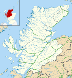
 Horse Island

