Holkerveen
Contenu soumis à la licence CC-BY-SA. Source : Article Holkerveen de Wikipédia en français (auteurs)
Regardez d'autres dictionnaires:
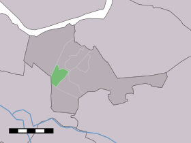
Holkerveen — Dutch town locator maps mun town caption = Holkerveen in the municipality of Nijkerk.Holkerveen (coord|52|12|N|5|27|E|type:city(480)) is a village in the Dutch province of Gelderland. It is a part of the municipality of Nijkerk, and lies about 6… … Wikipedia
Nijkerk railway station — Nijkerk Station statistics Coordinates 52°13′19″N … Wikipedia
Nijkerk — Municipality Flag … Wikipedia
Europastraße 232 — Basisdaten Gesamtlänge 172 km Land Niederlande … Deutsch Wikipedia
Rijksweg 28 — Vorlage:Infobox hochrangige Straße/Wartung/NL A Autosnelweg A28 in den Niederlanden … Deutsch Wikipedia
't Woud (Gueldre) — 52°11′46″N 5°33′22″E / 52.19611, 5.55611 … Wikipédia en Français
Driedorp — 52°12′25″N 5°31′7″E / 52.20694, 5.51861 … Wikipédia en Français
Hoevelaken — 52°10′27″N 5°27′35″E / 52.17417, 5.45972 … Wikipédia en Français
Nijkerk — Héraldique … Wikipédia en Français
Nijkerkerveen — 52°11′42″N 5°28′0″E / 52.195, 5.46667 … Wikipédia en Français
 Pays-Bas