Hoenzadriel
- Hoenzadriel
-
51° 45′ 00″ N 5° 20′ 00″ E / 51.75, 5.33333
Hoenzadriel est un village néerlandais de la commune de Maasdriel, situé dans la province du Gueldre. Le 1er janvier 2008, Hoenzadriel comptait 282 habitants.
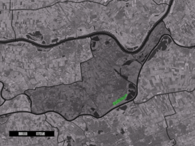
Géographie
Hoenzadriel est situé au sud de Kerkdriel, sur la rive droite de la Meuse, dans le sud-est du Bommelerwaard.
Histoire
En 1840, Hoenzadriel appartenait à la commune de Driel et comptait 61 maisons et 396 habitants[1].
Référence
- ↑ Alphabetisch register van alle bewoonde oorden des Rijks, Departement van Oorlog, Éd. Erven Doorman, 's-Gravenhage, 1850
Wikimedia Foundation.
2010.
Contenu soumis à la licence CC-BY-SA. Source : Article Hoenzadriel de Wikipédia en français (auteurs)
Regardez d'autres dictionnaires:
Hoenzadriel — Dutch town locator maps mun town caption = Hoenzadriel in the municipality of Maasdriel.Hoenzadriel (coord|51|45|N|5|20|E|type:city(160)) is a village in the Dutch province of Gelderland. It is a part of the municipality of Maasdriel, and lies… … Wikipedia
Maasdriel — Héraldique … Wikipédia en Français
Maasdriel — Infobox Settlement official name = Maasdriel mapsize = 280px subdivision type = Country subdivision name = Netherlands subdivision type1 = Province subdivision name1 = Gelderland area footnotes = (2006) area total km2 = 75.49 area land km2 =… … Wikipedia
List of places in the Netherlands — This is an alphabetical list of places (cities, towns, villages) in the Netherlands. Lists per province can be found at:* List of towns in Groningen * List of towns in Friesland * List of towns in Drente * List of towns in Overijssel * List of… … Wikipedia
Maasdriel — Gemeinde Maasdriel Flagge Wappen Provinz … Deutsch Wikipedia
Alem — 51° 47′ 13″ N 5° 20′ 37″ E / 51.7869, 5.34361 … Wikipédia en Français
Ammerzoden — 51° 45′ 00″ N 5° 13′ 00″ E / 51.75, 5.21666667 … Wikipédia en Français
Bommelerwaard — Situation du Bommelerwaard Le Bommelerwaard est une région naturelle des Pays Bas, située dans le sud ouest de la province du Gueldre. La région a une superficie d environ 147,6 km² et compte environ 48 000 habitants (1999). La circonférence … Wikipédia en Français
Hedel — 51° 44′ 48″ N 5° 15′ 33″ E / 51.7467, 5.25917 … Wikipédia en Français
Heerewaarden — 51°49′4″N 5°23′30″E / 51.81778, 5.39167 … Wikipédia en Français
 Pays-Bas