Hockessin
- Hockessin
-
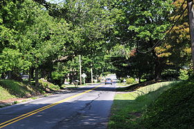
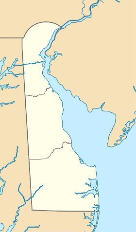
La ville de Hockessin (['hoʊkɛsin] ou [hoʊ'kɛsin] en anglais) est située dans le comté de New Castle, dans l’État du Delaware, aux États-Unis. Lors du recensement de 2000, la population s’élevait à 12 902 habitants. Densité : 176,1 hab./km² (456,3 hab./mi²). Sa superficie totale est de 26 km² (10 mi²). Coordonnées géographiques : 39°47′2″N 75°41′9″O / 39.78389, -75.68583.
Deux hypothèses s’opposent quant à l’origine du nom de la ville. Premièrement, une origine amérindienne : Hockessin viendrait de « hòkèsa », un mot lenape signifiant « morceaux d’écorce ». Seconde hypothèse, le nom viendrait de la prononciation du mot anglais « occasion » par les quakers qui ont peuplé la région.
Évolution démographique
La population de Hockessin a triplé depuis 1990.
Source
Wikimedia Foundation.
2010.
Contenu soumis à la licence CC-BY-SA. Source : Article Hockessin de Wikipédia en français (auteurs)
Regardez d'autres dictionnaires:
Hockessin — Lugar designado por el censo de los Estados Unidos Entrada a Hockessin … Wikipedia Español
Hockessin — Hockessin, DE U.S. Census Designated Place in Delaware Population (2000): 12902 Housing Units (2000): 4575 Land area (2000): 10.027170 sq. miles (25.970250 sq. km) Water area (2000): 0.012569 sq. miles (0.032553 sq. km) Total area (2000):… … StarDict's U.S. Gazetteer Places
Hockessin, DE — U.S. Census Designated Place in Delaware Population (2000): 12902 Housing Units (2000): 4575 Land area (2000): 10.027170 sq. miles (25.970250 sq. km) Water area (2000): 0.012569 sq. miles (0.032553 sq. km) Total area (2000): 10.039739 sq. miles… … StarDict's U.S. Gazetteer Places
Hockessin — Dieser Artikel wurde aufgrund von inhaltlichen Mängeln auf der Qualitätssicherungsseite des Projektes USA eingetragen. Hilf mit, die Qualität dieses Artikels auf ein akzeptables Niveau zu bringen, und beteilige dich an der Diskussion! … Deutsch Wikipedia
Hockessin — Original name in latin Hockessin Name in other language State code US Continent/City America/New York longitude 39.78761 latitude 75.6966 altitude 79 Population 13527 Date 2011 05 14 … Cities with a population over 1000 database
Hockessin, Delaware — Infobox Settlement official name = Hockessin, Delaware settlement type = CDP nickname = motto = imagesize = image caption = image mapsize = 250px map caption = Location of Hockessin, Delaware mapsize1 = map caption1 = subdivision type = Country… … Wikipedia
19707 — Hockessin, De (Miscellaneous » ZIP Codes) … Abbreviations dictionary
Delaware Route 41 — Lancaster Pike Newport Gap Pike Route information Maintained by DelDOT Length … Wikipedia
Gebhart v. Belton — Gebhardt v. Belton , 33 Del. Ch. 144, 87 A.2d 862 (Del. Ch. 1952), aff d , 91 A.2d 137 (Del. 1952), was a case decided by the Delaware Court of Chancery in 1952 and affirmed by the Delaware Supreme Court in the same year. Gebhart was one of the… … Wikipedia
National Register of Historic Places listings in New Castle County, Delaware — This is a list of the National Register of Historic Places listings in New Castle County, Delaware. Map of all coordinates from Google Map of all coordinates from Bing … Wikipedia
 États-Unis
 Delaware


