High Holborn
Contenu soumis à la licence CC-BY-SA. Source : Article High Holborn de Wikipédia en français (auteurs)
Regardez d'autres dictionnaires:
High Holborn — is a road in Holborn in central London, England. It starts in the west near St Giles Circus, then goes east, past Bloomsbury Street, the Kingsway and Southampton Row, and continues east. The road becomes Holborn at the junction with Gray s Inn… … Wikipedia
High Holborn — West from Holborn Bars to Drury Lane, outside the City boundary (P.O. Directory). First mention: High Holborne, 1544 (L. and P. H. VIII. XIX. (1), p. 622). Referred to as Holborne in earlier records, as in 14 Ed. III. (Anc. Deeds, B.… … Dictionary of London
Holborn tube station — Holborn is a station of the London Underground in Holborn in London, located at the junction of High Holborn and Kingsway. It is on the Piccadilly Line between Covent Garden and Russell Square, and on the Central Line between Tottenham Court Road … Wikipedia
Holborn — For other uses, see Holborn (disambiguation). Coordinates: 51°31′02″N 0°07′06″W / 51.5172°N 0.1182°W / 51.5172; 0.1182 … Wikipedia
Holborn — 1) (Borough) One of the boroughs in the County of London, outside the City boundary, extending from Holborn Circus to Tottenham Court Road, north to St. Pancras parish, and south to the City of Westminster. The history of the borough and … Dictionary of London
Holborn — 51° 31′ 02″ N 0° 07′ 06″ W / 51.5172, 0.1182 Holborn est le nom d un quartier du … Wikipédia en Français
Holborn (London Underground) — Außenansicht des Eingangsbereichs … Deutsch Wikipedia
Metropolitan Borough of Holborn — Holborn Motto: Multi Pertransibunt et Augebitur Scientia (Many shall pass through and learning shall be increased) Holborn within the County of London Geography … Wikipedia
High Court of Justice — For other uses, see High Court of Justice (disambiguation). High Court of Justice Royal Courts of Justice, The Strand Established 1875 … Wikipedia
High Court of Justice (England und Wales) — Royal Courts of Justice, Gerichtsgebäude in London, welches auch den High Court of Justice beinhaltet Der High Court of Justice (ugs. High Court und High Court of England and Wales, EWHC; Oberstes Zivilgericht) ist neben dem Crown Court… … Deutsch Wikipedia
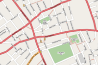 Carte de High Holborn
 Les Holborn Bars
