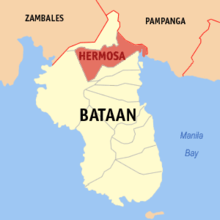
Hermosa (Bataan)
Contenu soumis à la licence CC-BY-SA. Source : Article Hermosa (Bataan) de Wikipédia en français (auteurs)
Regardez d'autres dictionnaires:
Hermosa, Bataan — Infobox Philippine city infoboxtitle = Hermosa, Bataan locatormapfile = region = Central Luzon (Region III) province = Bataan districts = 1st district of Bataan barangays = 23 class = 2nd class municipality… … Wikipedia
Hermosa — (Bataan) Pour les articles homonymes, voir Hermosa. Carte de Bataan avec localisation de Hermosa Hermosa est une municipalité de la prov … Wikipédia en Français
Hermosa — may refer to:* The Spanish word for Formosa * Hermosa, Bataan, Philippines;United States * Hermosa, Chicago, Illinois * Hermosa, New Mexico * Hermosa, South Dakota * Hermosa Beach, California … Wikipedia
Bataan — Infobox Philippine province name = Bataan sealfile = Ph seal bataan.png region = Central Luzon (Region III) capital = Balanga City founded = 1754 pop2000 = 557,659 pop2000rank = 46th largest popden2000 = 406 popden2000rank = 12th highest areakm2 … Wikipedia
Hermosa — Municipality of Hermosa Lage von Hermosa in der Provinz Bataan Basisdaten Bezirk: Cent … Deutsch Wikipedia
Bataan Provincial Expressway — The Bataan Provincial Expressway (BPE or BPEx), also called Roman Super Highway, is a toll two lane freeway that connects Bataan to the provinces of the Central Luzon region in the Philippines.The expressway begins in Layac, Dinalupihan, Bataan… … Wikipedia
Bataan — Lage von der Provinz Bataan Bataan Bataan ist eine philippinische Provinz im Bezirk Central Luzon auf … Deutsch Wikipedia
Bataan — 14° 40′ 00″ N 120° 25′ 01″ E / 14.6667, 120.417 … Wikipédia en Français
Bataan Peninsula — ▪ peninsula, Philippines peninsula in central Luzon, Philippines, sheltering Manila Bay (east) from the South China Sea. It is about 30 miles (50 km) long and 15 miles (25 km) wide. Corregidor Island lies just off its southern tip at the… … Universalium
Dinalupihan, Bataan — Dinalupihan Municipality Map of Bataan showing the location of Dinalupihan … Wikipedia

