Havøysund
- Havøysund
-
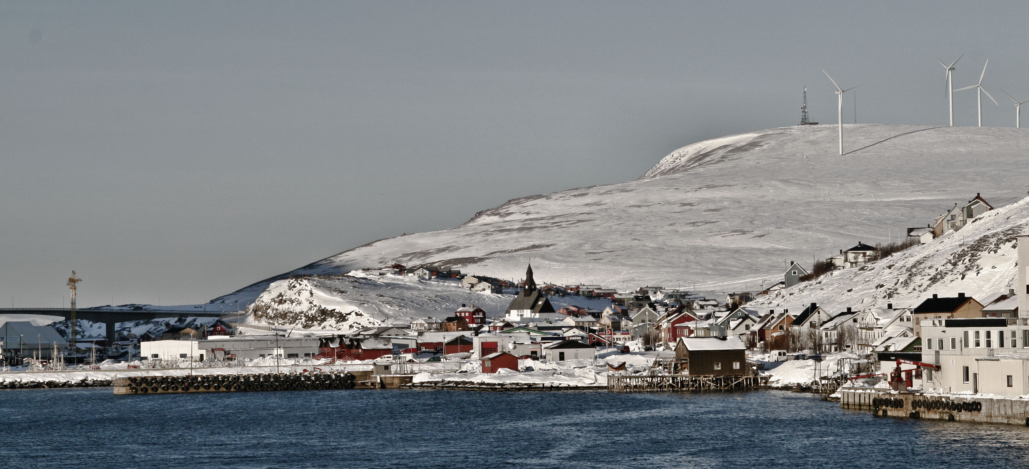
Havøysund est le centre administratif de la municipalité de Måsøy, en Norvège. Il comptait en 2005 1 138 habitants. Situé sur le continent, il est relié à la Havøya (île) par le pont de Havøysund. Escale sur le trajet du Hurtigruten entre Hammerfest et Honningsvåg.

Vue de Havøysund en hiver
Wikimedia Foundation.
2010.
Contenu soumis à la licence CC-BY-SA. Source : Article Havøysund de Wikipédia en français (auteurs)
Regardez d'autres dictionnaires:
Havøysund — is the administrative centre of the Måsøy municipality, Norway. Its population, in 2005, was 1,138. Located on the mainland, it is connected to Havøya with the Havøysund Bridge. Havøysund is also a stop on Hurtigruten, between Hammerfest and… … Wikipedia
Havøysund — en el invierno de 2007. Havøysund es una localidad de Noruega, capital del municipio de Måsøy, provincia de Finnmark. En el año 2007 tenía una población de 1,138 habitantes. Está unida a Havøya por un puente la cual es también una parada entre… … Wikipedia Español
Havøysund — Vorlage:Infobox Insel/Wartung/Fläche fehltVorlage:Infobox Insel/Wartung/Höhe fehlt Havøysund Ansicht von Havøysund Gewässer … Deutsch Wikipedia
Havøysund Hotell og Rorbuer AS — (Havøysund,Норвегия) Категория отеля: 4 звездочный отель Адрес: Strandgata 149, 9690 Havøysund, Норве … Каталог отелей
Havøysund Bridge — (Havøysundbrua) is a cantilever bridge that crosses Havøysundet from the mainland to the fishing village Havøysund on Havøya in Finnmark county in Norway. The bridge is 293 metres long, and the main span is 124 metres.Havøysund Bridge was opened… … Wikipedia
Norwegian County Road 889 — 889 … Wikipedia
National Tourist Routes in Norway — County Road 55 passes by Kvinnafossen Sign for a … Wikipedia
Hurtigroute — Logo der Hurtigruten Hurtigruten [hʉrtirʉtən] (norwegisch für Die schnelle Linie) ist die Bezeichnung für die norwegische Postschiffslinie, die seit 1893 die Orte der über 2700 Kilometer langen norwegischen Westküste verbindet. Heute fahren die… … Deutsch Wikipedia
Hurtigruta — Logo der Hurtigruten Hurtigruten [hʉrtirʉtən] (norwegisch für Die schnelle Linie) ist die Bezeichnung für die norwegische Postschiffslinie, die seit 1893 die Orte der über 2700 Kilometer langen norwegischen Westküste verbindet. Heute fahren die… … Deutsch Wikipedia
Hurtigrute — Logo der Hurtigruten Hurtigruten [hʉrtirʉtən] (norwegisch für Die schnelle Linie) ist die Bezeichnung für die norwegische Postschiffslinie, die seit 1893 die Orte der über 2700 Kilometer langen norwegischen Westküste verbindet. Heute fahren die… … Deutsch Wikipedia


 Norvège


 Catégorie :