Garmerwolde
Contenu soumis à la licence CC-BY-SA. Source : Article Garmerwolde de Wikipédia en français (auteurs)
Regardez d'autres dictionnaires:
Ten Boer — Infobox Settlement official name = Ten Boer mapsize = 280px subdivision type = Country subdivision name = Netherlands subdivision type1 = Province subdivision name1 = Groningen area footnotes = (2006) area total km2 = 45.71 area land km2 = 45.25… … Wikipedia
Kinderdijk — Coordinates: 51°53′N 4°38′E / 51.883°N 4.633°E / 51.883; 4.633 … Wikipedia
List of places in the Netherlands — This is an alphabetical list of places (cities, towns, villages) in the Netherlands. Lists per province can be found at:* List of towns in Groningen * List of towns in Friesland * List of towns in Drente * List of towns in Overijssel * List of… … Wikipedia
De Adriaan, Haarlem — Windmill De Adriaan De Adriaan is a windmill in the Netherlands that burnt down in 1932 and was rebuilt in 2002. The original windmill dates from 1779 and the mill has been a distinctive part of the skyline of Haarlem for centuries. Contents … Wikipedia
Achter-Thesinge — 53°16′51″N 6°39′27″E / 53.28083, 6.6575 … Wikipédia en Français
Damsterdiep — Situation du canal sur une carte des Pays Bas Caractéristiques Statut actuel En service, faible fréquentation professionnelle Longueur 27� … Wikipédia en Français
Kröddeburen — 53°18′2″N 6°43′28″E / 53.30056, 6.72444 … Wikipédia en Français
Lellens — 53°18′6″N 6°42′33″E / 53.30167, 6.70917 … Wikipédia en Français
Liste des localités des Pays-Bas par code postal — Cette page est une liste des localités (villes, villages) des Pays Bas par code postal. Les localités ne possédant pas leur propre code postal ne figurent pas dans cette liste. Sommaire 1 1000 1999 1.1 1000 1099 1.2 1100 1199 … Wikipédia en Français
Nieuwe Diep — Damsterdiep Damsterdiep Situation du canal sur une carte des Pays Bas Caractéristiques Statut actuel En service, faible fréquentation professionnelle Longueur 27 km … Wikipédia en Français
 Pays-Bas
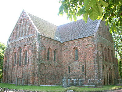
 L'église de Garmerwolde
 Catégories :