Fort Pike
Contenu soumis à la licence CC-BY-SA. Source : Article Fort Pike de Wikipédia en français (auteurs)
Regardez d'autres dictionnaires:
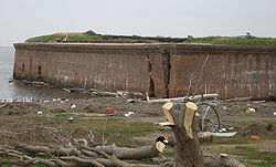
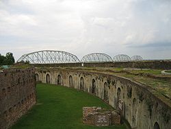
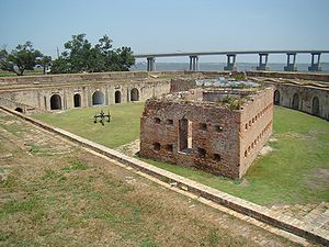
Fort Pike — is a decommissioned 19th century fort which formerly guarded the Rigolets pass in Louisiana. It is now within the city limits of New Orleans, and was long a tourist attraction. It was damaged by the Hurricane Katrina storm surge in 2005.The fort… … Wikipedia
Fort Pike Bridge — Infobox Bridge bridge name= Fort Pike Bridge caption= official name= also known as= Rigolets Bridge carries= 2 lanes of US 90 crosses= Rigolets locale= New Orleans and Slidell, Louisiana maint= id= design= Through truss swing bridge(old), Box… … Wikipedia
Fort Macomb — is a 19th century fortress in Louisiana, on the western shore of Chef Menteur Pass.The fort is adjacent to the Venetian Isles community, now legally within the city limits of New Orleans, Louisiana, although some miles distant from the city when… … Wikipedia
Fort Macomb — 30°03′53″N 89°48′14″O / 30.06472, 89.80389 … Wikipédia en Français
Fort Tompkins — Infobox Military Structure name=Fort Tompkins (I)(II)(III)(IV) partof= location= caption= type=Star Fort built= builder=New York Army National Guard materials= height= used=1812 1815, 1860 1865 demolished= condition= ownership= controlledby=… … Wikipedia
Pike Island — is an island at the confluence of the Mississippi and Minnesota Rivers in southwest Ramsey County in the Twin Cities metropolitan area of Minnesota. It is a portion of the 100,000 acres (400 km²) of land purchased from the Mdewakanton Sioux… … Wikipedia
Fort Detrick — Frederick, Maryland Type Military Base Built 1931 In use 1931 Present Controlled by … Wikipedia
Fort Allen — was a structure that was built in 1774 in Hempfield Township, Pennsylvania. It was built for protection from Indian attacks. Roughly 800 pioneer settlers in Hempfield, a large number of them German, had petitioned the state for aid and protection … Wikipedia
Fort Niagara — Youngstown, New York Fort Niagara 1728 Type Trading Post … Wikipedia
Fort Armstrong — Fort Armstrong, Zeichnung um 1898 Fort Armstrong war ein Fort der Vereinigten Staaten im Bundesstaat Illinois. Es befand sich auf der Rock Island genannten Insel im Mississippi River. Heute liegt die Insel im Gebiet der nach ihr benannten Stadt… … Deutsch Wikipedia


