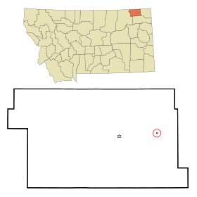
Flaxville
Contenu soumis à la licence CC-BY-SA. Source : Article Flaxville de Wikipédia en français (auteurs)
Regardez d'autres dictionnaires:
Flaxville — Flaxville, MT U.S. town in Montana Population (2000): 87 Housing Units (2000): 59 Land area (2000): 0.103853 sq. miles (0.268978 sq. km) Water area (2000): 0.000000 sq. miles (0.000000 sq. km) Total area (2000): 0.103853 sq. miles (0.268978 sq.… … StarDict's U.S. Gazetteer Places
Flaxville, MT — U.S. town in Montana Population (2000): 87 Housing Units (2000): 59 Land area (2000): 0.103853 sq. miles (0.268978 sq. km) Water area (2000): 0.000000 sq. miles (0.000000 sq. km) Total area (2000): 0.103853 sq. miles (0.268978 sq. km) FIPS code:… … StarDict's U.S. Gazetteer Places
Flaxville, Montana — Infobox Settlement official name = Flaxville, Montana settlement type = Town nickname = motto = imagesize = image caption = image imagesize = image caption = image mapsize = 250px map caption = Location of Flaxville, Montana mapsize1 = map… … Wikipedia
59222 — Flaxville, Mt (Miscellaneous » ZIP Codes) … Abbreviations dictionary
Daniels County, Montana — Location in the state of Montana … Wikipedia
Mantua, Utah — Town Mantua as seen from U.S. Route 91 … Wikipedia
List of cities and towns in Montana — Below is a complete [As of FY2006, citation |title= Montana Local Government Profile, Fiscal Year 2006 |last= Jelinkski |first= Jane |last2= Sypinski |first2= Edward |url= http://www.montana.edu/wwwlgc/publications/data/profiles.pdf |publisher=… … Wikipedia
Montana locations by per capita income — Montana is the forty sixth richest state in the United States of America, with a per capita income of $17,151 (2000). Montana counties ranked by per capita income There are fifty six counties located in Montana, none of which are in the 100… … Wikipedia
Mantua Township, Portage County, Ohio — Township Historic Snow Home, built in 1815 … Wikipedia
Daniels County — Courthouse in Scobey, gelistet im NRHP Nr. 95000535[1] Verwaltung U … Deutsch Wikipedia
 États-Unis
 Montana
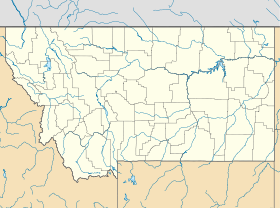