Erromango
- Erromango
-
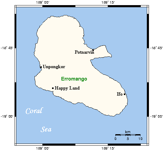
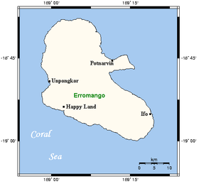
Erromango est la plus grande île de la province Taféa, au sud du Vanuatu, dans le Pacifique Sud. En 2009, elle était peuplée de 1 959 habitants[1]. Elle a une superficie de 888,1 km2 et son point culminant se trouve à 886 m d’altitude[2].
Histoire
Cette section est vide, insuffisamment détaillée ou incomplète.
Votre aide est la bienvenue !
Culture
Les langues indigènes d’Erromango sont le sie et l’ura[3], ce dernier étant menacé d’extinction.
Références
Voir aussi
Liens internes
Lien externe
Wikimedia Foundation.
2010.
Contenu soumis à la licence CC-BY-SA. Source : Article Erromango de Wikipédia en français (auteurs)
Regardez d'autres dictionnaires:
Erromango — Karte von Erromango Gewässer Pazifischer Ozean Inselgruppe … Deutsch Wikipedia
Erromango — (coord|18|48|S|169|4|E) is the largest island in Tafea, the southernmost province of Vanuatu. Its highest point is Mount Santop, at 886 m. Its largest villages are Port Narvin (Potnarvin) and Dillons Bay (Upongkor). The total area of Erromango is … Wikipedia
Erromango — Saltar a navegación, búsqueda Mapa de la isla de Erromango. Erromango es la isla más grande de Tafea, la provincia más meridional de Vanuatu. Posee un área de 888 km². El monte Santop, con 886 msnm, es el punto más alto de la isla. Su… … Wikipedia Español
Erromango — (Irromango), eine der größeren Inseln des Archipels der Neuen Hebriden (Polynesien), 13 Meilen im Umfang; Sandelholzwaldungen, von Papuas bewohnt u. gut angebaut. Von den Eingeborenen wurde 1839 der englische Missionär Williams ermordet … Pierer's Universal-Lexikon
Erromango — Erromango, große Insel der Neu Hebriden im Australocean, fruchtbar, von Papuas bewohnt, wohlangebaut … Herders Conversations-Lexikon
Erromango — île de Vanuatu, au S. E. de l île Vaté et au N. O. de l île Tanna, avec laquelle elle forme une Région; v. princ. Ipota … Encyclopédie Universelle
Erromango — ▪ island, Vanuatu also spelled Eromanga volcanic island of Vanuatu, in the southwestern Pacific Ocean. The island, with an area of 376 square miles (975 square km), rises in the interior to 2,907 feet (886 metres) at Santop. It had a… … Universalium
Eromango — Erromango Erromango Carte d Erromango. Géographie Pays … Wikipédia en Français
Erromangan — (Sye) is the language spoken on the island Erromango in the Tafea region of the Vanuatu islands. The islands of Vanuatu are 2.000 km to the North East from Australia. Although the island is quite large (887 km²), the total number of speakers of… … Wikipedia
Tanna (Vanuatu) — Tanna Karte von Tanna Gewässer Pazifischer Ozean Inselgruppe … Deutsch Wikipedia
 Vanuatu
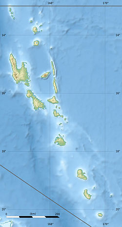
 Erromango