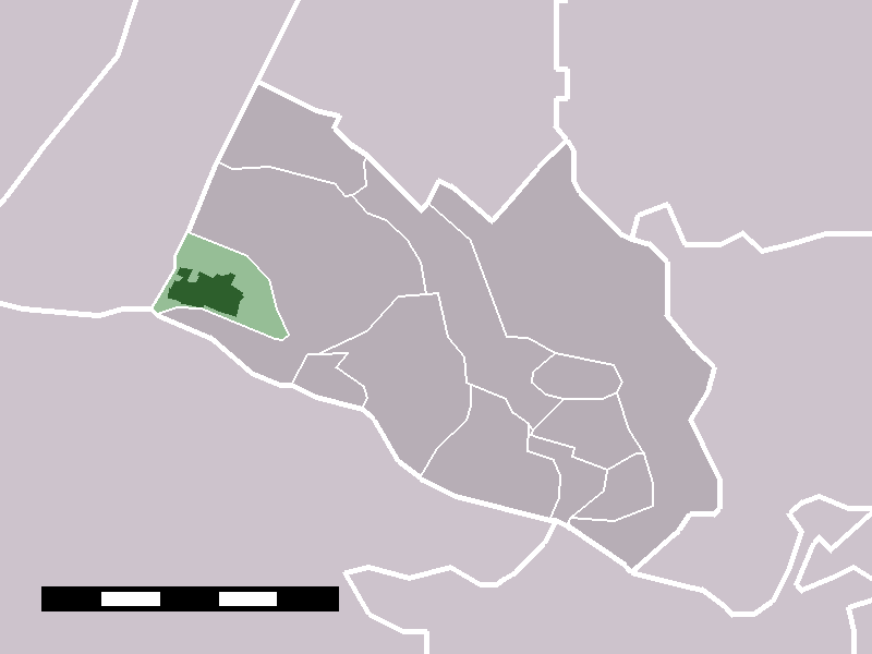
Elst (Utrecht)
Contenu soumis à la licence CC-BY-SA. Source : Article Elst (Utrecht) de Wikipédia en français (auteurs)
Regardez d'autres dictionnaires:
Elst (Utrecht) — Dutch town locator maps mun town caption = Elst in the municipality of Rhenen.Elst (coord|51|59|N|5|30|E|type:city(3008)) is a town in the Dutch province of Utrecht. It is a part of the municipality of Rhenen, and lies about 5 km southwest of… … Wikipedia
Elst–Dordrecht railway — Overview Status Operational Locale The Netherlands Termini Elst railway station Dordrecht railway station Operation … Wikipedia
Elst — ist der Name folgender Orte: Elst, Ortsteil von Brakel, Provinz Ostflandern in Belgien Elst, Ortsteil von Riemst, Provinz Limburg in Belgien Elst, liegt zum Teil in der Gemeinde Amerongen und zum Teil in der Gemeinde Rhenen, Provinz Utrecht in… … Deutsch Wikipedia
Elst — is the name of a number of towns:*Elst; a village and former municipality, now part of Overbetuwe, in Gelderland *Elst; a village in the municipality of Rhenen, in the province of Utrecht *Elst; a village in the municipality of Maasdonk, in North … Wikipedia
Elst — Cette page d’homonymie répertorie les différents sujets et articles partageant un même nom. Sommaire 1 Patronymie 2 Toponymie 2.1 Bel … Wikipédia en Français
Bahnstrecke Utrecht–Boxtel — Utrecht–Boxtel Ein Zug auf der Brücke über die Lek, bei Culemborg … Deutsch Wikipedia
12695 Utrecht — Infobox Planet minorplanet = yes width = 25em bgcolour = #FFFFC0 apsis = name = Utrecht symbol = caption = discovery = yes discovery ref = discoverer = E. W. Elst discovery site = European Southern Observatory discovered = April 1, 1989… … Wikipedia
Achterberg (Utrecht) — 51°58′18″N 5°35′8″E / 51.97167, 5.58556 … Wikipédia en Français
List of windmills in Utrecht — A list of windmills in the Dutch province of Utrecht.{| class= wikitable ! Location! Name of mill! Type! Built! Notes! Photograph Abcoude De Broekzijde Molen Grondzeiler 1641 [http://www.molendatabase.nl/nederland/molen.php?nummer=826… … Wikipedia
Railway stations in the Netherlands — Railways in the Netherlands There are 392 railway stations in the Netherlands, including 5 railway stations which are only served during events, 1 which exists only to facilitate pilgrimage to a nearby site and 1 which exists only to facilitate… … Wikipedia
 Pour les articles homonymes, voir Elst.
 Pays-Bas
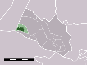

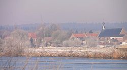 Vue sur Elst depuis l'autre rive du Rhin inférieur
 Catégories :