Adelong
Contenu soumis à la licence CC-BY-SA. Source : Article Adelong de Wikipédia en français (auteurs)
Regardez d'autres dictionnaires:
Adelong, New South Wales — Infobox Australian Place | type = town name = Adelong state = nsw caption = Main street lga = Tumut Shire postcode = 2729 pop = 829 mean rain days = 99.2 pop footnotes = est = 1840 elevation= 303 maxtemp = 21.9 mintemp = 6.7 rainfall = 788.1… … Wikipedia
Adelong — /ˈædəlɒŋ/ (say aduhlong) noun a former gold rush town in south eastern NSW, near Tumut; founded in 1856 …
Tumblong, New South Wales — Infobox Australian Place | type = town name = Tumblong state = nsw caption = Tumblong Tavern lga = Gundagai Shire Council postcode = 2729 pop = 200 (within 7 km radius) est = elevation= 303 maxtemp = mintemp = rainfall = county = Wynyard stategov … Wikipedia
Hume Highway — Hume Freeway Proposed … Wikipedia
Grahamstown (Riverina), New South Wales — Infobox Australian Place | type = town name = Grahamstown state = nsw caption = Grahamstown lga = postcode = 2729 coordinates = coord|35|15|53|S|148|2|7|E |scale:100000 region:AU NSW |display=title,inline |name=Grahamstown, New South Wales pop =… … Wikipedia
Arthur Fuller — Arthur Nieberding Fuller (24 October 1893 – 21 March 1987) was a long serving member of the Australian House of Representatives.Born in Gundagai to a goldminer and his wife, Fuller spent his childhood in the New South Wales goldfields. He later… … Wikipedia
Telephone numbers in Australia — [Telecommunications Numbering Plan 1997 as amended 4th January, 2008] The Australian telephone numbering plan describes the allocation of phone numbers in Australia. It has changed many times, the most recent major reorganisation by the… … Wikipedia
Wondalga, New South Wales — Infobox Australian Place | type = town name = Wondalga state = nsw caption = Wondalga lga = postcode = 2729 pop = 361 (within 7 km radius) est = elevation= 361 maxtemp = mintemp = rainfall = county = Wynyard stategov = Wagga Wagga fedgov = dist1 … Wikipedia
John Prowse — John Henry Prowse (16 June 1871 ndash; 20 May 1944) was an Australian politician. Born in Adelong, New South Wales, he was educated at public schools and then at Kings College, Melbourne. He became an insurance agent and then a station owner in… … Wikipedia
Contenu:Australie — Projet:Australie/Liste des articles Liste mise à jour régulièrement par MyBot (d · c · b) à partir des articles liés au bandeau {{Portail Australie}} Modifications récentes des articles ayant le bandeau de ce portail… … Wikipédia en Français
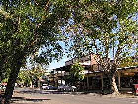
 La grand rue d'Adelong
 Australie

