District de Sipaliwini
- District de Sipaliwini
-
Sipaliwini
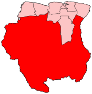
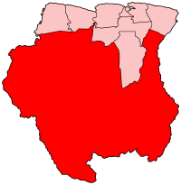
Localisation du district de Sipaliwini sur la carte du Suriname
Sipaliwini est l'un des districts du Suriname. Le district n'a aucune capitale.
Resorts

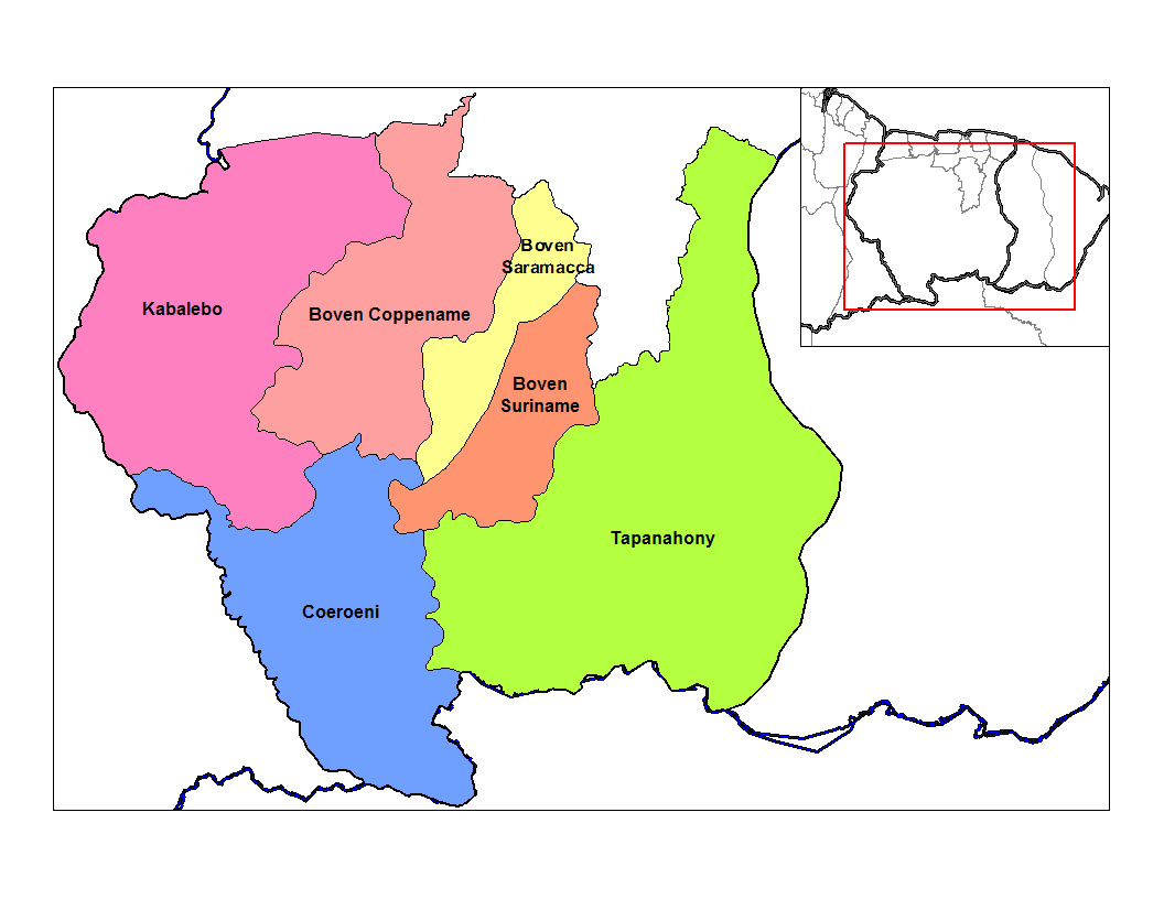
Resorts du district de Sipaliwini
Le district de Sipaliwini est divisé en six resorts :
- Boven Coppename,
- Boven Saramacca,
- Boven Suriname,
- Coeroeni,
- Kabalebo,
- Tapanahony,
Municipalités du district
- Anapaike,
- Apetina,
- Apoera,
- Aurora,
- Benzdorp,
- Bakhuys,
- Bitagron,
- Botopasi,
- Cottica,
- Djumu,
- Goddo,
- Kajana,
- Kamp 52,
- Kwamalasamutu,
- Nieuw Jacobkondre,
- Pelelu Tepu,
- Pokigron,
- Pontoetoe.
Catégorie : Districts du Suriname
Wikimedia Foundation.
2010.
Contenu soumis à la licence CC-BY-SA. Source : Article District de Sipaliwini de Wikipédia en français (auteurs)
Regardez d'autres dictionnaires:
Sipaliwini (district) — Sipaliwini Localisation du district de Sipaliwini sur la carte du Suriname Sipaliwini est l un des districts du Suriname. Le district n a aucune capitale. Resorts … Wikipédia en Français
Sipaliwini — Localisation du district de Sipaliwini sur la carte du Suriname Sipaliwini est l un des districts du Suriname. Le district n a aucune capitale. Resorts … Wikipédia en Français
Sipaliwini District — Sipaliwini is the largest district of Suriname, located in the south. Sipaliwini does not have a regional capital as it is directly administered by the national government in Paramaribo. The main villages in the district are Apetina, Apoera,… … Wikipedia
Coronie District — Map of Suriname showing Coronie district Coronie is a district of Suriname, situated on the coast. Coronie s capital city is Totness, with other towns including Corneliskondre, Friendship, Jenny. The district border the Atlantic Ocean to the… … Wikipedia
Marowijne District — Map of Suriname showing Marowijne district Marowijne is a district of Suriname, located on the north east coast. Marowijne s capital city is Albina, with other towns including Moengo and Wanhatti. The district borders the Atlantic Ocean to the… … Wikipedia
Nickerie District — Map of Suriname showing Nickerie district Nickerie is a district of Suriname, on the north west coast. Nickerie s capital city is Nieuw Nickerie, the second largest city in the country. Other towns include Washoda and Wageningen. The district… … Wikipedia
Commewijne District — Map of Suriname showing Commewijne district Commewijne is a district of Suriname, located on the right bank of the Suriname River. Commewijne s capital city is Nieuw Amsterdam. Alliance is another major town. The district has a population of… … Wikipedia
Saramacca District — Coordinates: 5°46′57″N 55°37′29″W / 5.7825°N 55.62472°W / 5.7825; 55.62472 … Wikipedia
Brokopondo (district) — 4° 46′ 21″ N 55° 07′ 46″ W / 4.7725, 55.1294 … Wikipédia en Français
Cottica — For a river in Suriname, see Cottica River. Cottica … Wikipedia