Achterhoek
- Achterhoek
-

Localisation de Achterhoek
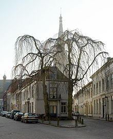
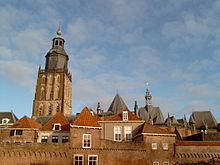
Achterhoek (en néerlandais : « arrière-coin ») est une région de l'est des Pays-Bas. Elle couvre la partie est de la province du Gueldre et une partie de l'Allemagne. Le caractère de la région est fortement rural.
Géographie
Les villes les plus importantes sont : Doetinchem, Winterswijk, Doesburg et Zutphen. Les bois autour de Winterswijk sont renommés pour être particulièrement esthétiques.
Histoire
Doesburg et Zutphen sont des villes qui faisaient partie de la ligue hanséatique.
Économie
La bière Grolsch a d'abord été brassée à Groenlo.
Commune des Achterhoek
Wikimedia Foundation.
2010.
Contenu soumis à la licence CC-BY-SA. Source : Article Achterhoek de Wikipédia en français (auteurs)
Regardez d'autres dictionnaires:
Achterhoek — Karte des Achterhoek Schloss Hackfort im Achterhoek … Deutsch Wikipedia
Achterhoek — The Achterhoek is a region in the eastern part of the Netherlands. Its name (meaning back corner ) is geographically appropriate because the area lies in the Eastern most part of Gelderland, and therefore of the Netherlands, protruding into… … Wikipedia
Achterhoek (disambiguation) — Achterhoek may refer to:* Achterhoek, a region in the east of Gelderland, the Netherlands * Achterhoek (Nijkerk), a village in Gelderland, the Netherlands * Achterhoek (Overijssel), a village in Overijssel, the Netherlands * Achterhoek (Germany) … Wikipedia
Achterhoek (Overijssel) — Achterhoek is a hamlet in the Dutch province of Overijssel. It is located in the municipality of Hof van Twente, about 2km northwest of the village Markelo. ANWB Topografische Atlas Nederland , Topografische Dienst and ANWB, 2005.] Until 2001,… … Wikipedia
Achterhoek (Nijkerk) — Dutch town locator maps mun town caption = Achterhoek in the municipality of Nijkerk.Achterhoek is a hamlet in the Dutch province of Gelderland. It is a part of the municipality of Nijkerk, and lies about 6 km north of Amersfoort. ANWB… … Wikipedia
Gelderschen Achterhoek — Karte der Achterhoek Schloss Hackfort in der Achterhoek … Deutsch Wikipedia
Gelderse Achterhoek — Karte der Achterhoek Schloss Hackfort in der Achterhoek … Deutsch Wikipedia
Region Achterhoek — Karte der Achterhoek Schloss Hackfort in der Achterhoek … Deutsch Wikipedia
Wilp-Achterhoek — 52°12′45″N 6°5′10″E / 52.2125, 6.08611 … Wikipédia en Français
Twente-Achterhoek-Rinne — Als Twente Achterhoek Rinne wird eine eiszeitliche Rinne bezeichnet, die sich vom Niederrhein bis westlich von Bentheim nachweisen lässt.[1] Die Rinne wurde von nach Süden abfließendem Schmelzwasser ausgespült. Sie entstand ähnlich und… … Deutsch Wikipedia


