Crary
Contenu soumis à la licence CC-BY-SA. Source : Article Crary de Wikipédia en français (auteurs)
Regardez d'autres dictionnaires:
Crary — may refer to: People Albert P. Crary, polar geophysicist and glaciologist Isaac E. Crary, U.S. Representative from Michigan John Crary (ca. 1784 1848), New York politician William Crary Brownell, an American essayist and art critic Places Crary… … Wikipedia
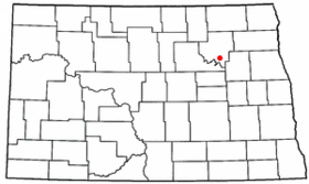
Crary — ist der Familienname folgender Personen: Albert P. Crary (1911–1997), US amerikanischer Geophysiker Isaac E. Crary (1804–1854), US amerikanischer Politiker John Crary, US amerikanischer Politiker Crary bezeichnet außerdem: Crary (North Dakota),… … Deutsch Wikipedia
Crary — Crary, ND U.S. city in North Dakota Population (2000): 149 Housing Units (2000): 54 Land area (2000): 0.878483 sq. miles (2.275261 sq. km) Water area (2000): 0.046481 sq. miles (0.120384 sq. km) Total area (2000): 0.924964 sq. miles (2.395645 sq … StarDict's U.S. Gazetteer Places
Crary, ND — U.S. city in North Dakota Population (2000): 149 Housing Units (2000): 54 Land area (2000): 0.878483 sq. miles (2.275261 sq. km) Water area (2000): 0.046481 sq. miles (0.120384 sq. km) Total area (2000): 0.924964 sq. miles (2.395645 sq. km) FIPS… … StarDict's U.S. Gazetteer Places
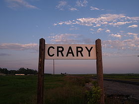
Crary, North Dakota — City Sign at Crary … Wikipedia
Crary Mountains — map Crary Mountains (76°48′S 117°40′W … Wikipedia
Crary Mills, New York — Hamlet … Wikipedia
Crary Bank — (75°0′S 169°0′E / 75°S 169°E / 75; 169) is a northeast trending undersea bank of the central Ross continental shelf named for A.P.Crary (1911–1987), American geophysicist. Named in association with Crary Ice Ris … Wikipedia
Crary Knoll — (78°16′S 161°37′E / 78.267°S 161.617°E / 78.267; 161.617) is a symmetrical ice covered knoll rising to 1,520 m, 2 nautical miles (3.7 km) south southeast of Holmes Block in the Skelton Glacier … Wikipedia
Crary Ice Rise — is an Antarctic ice rise in the south central part of the Ross Ice Shelf. At 82°56 S, it is the southernmost ice rise. The feature was investigated by the USARP Ross Ice Shelf Project in the 1970s. The name came into use among USARP workers and… … Wikipedia

 États-Unis
 Dakota du Nord


