Comerío (Puerto Rico)

Comerío (Puerto Rico)

Comerío (Porto Rico)

Comerío (Porto Rico)
Blason de Comerío (Porto Rico)
Héraldique

Administration
Pays États-Unis États-Unis
Collectivité Porto Rico Porto Rico
Géographie
Superficie 7 300 ha = 73 km²
Démographie
Population 20 002 hab. (2006)
Densité 274 hab./ km²
Localisation
Localisation de Comerío (Porto Rico)

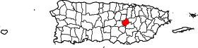
La municipalité de Comerío, sur l'ile de Porto Rico (Code International : PR.CM) couvre une superficie de 73 km² et regroupe 20 002 habitants (au 31 décembre 2006).

Sommaire

Histoire

Géographie

Article détaillé : Géographie de Porto Rico
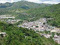
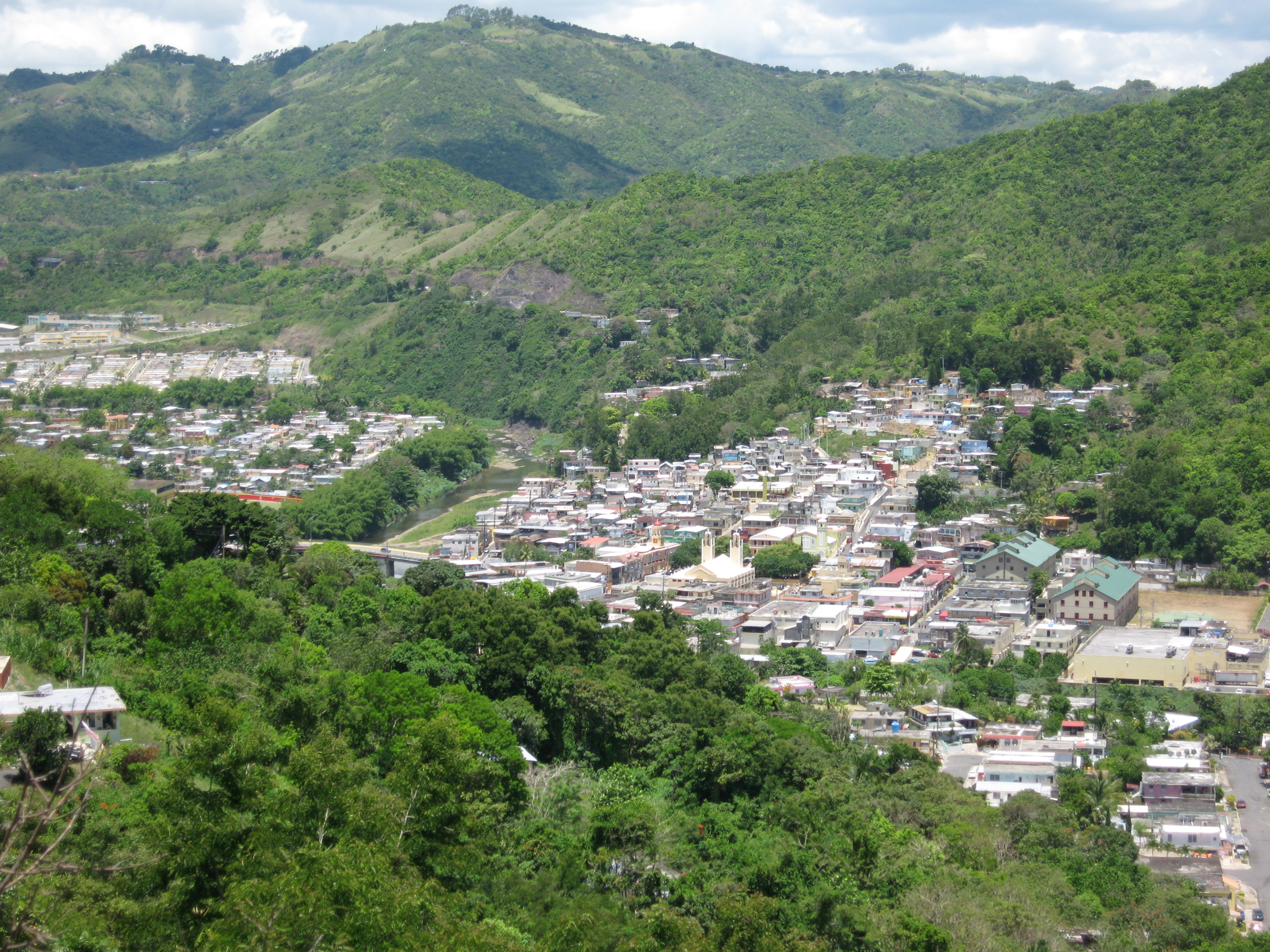
Économie

Tourisme

Culture

Liens externes


Le Commonwealth de Porto Rico

Adjuntas - Aguada - Aguadilla - Aguas Buenas - Aibonito - Añasco - Arecibo - Arroyo - Barceloneta - Barranquitas - Bayamón - Cabo Rojo - Caguas - Camuy - Canóvanas - Carolina - Cataño - Cayey - Ceiba - Ciales - Cidra - Coamo - Comerío - Corozal - Culebra - Dorado - Fajardo - Florida - Guánica - Guayama - Guayanilla - Guaynabo - Gurabo - Hatillo - Hormigueros - Humacao - Isabela - Jayuya - Juana Díaz - Juncos - Lajas - Lares - Loíza - Luquillo - Manatí - Las Marías - Maricao - Maunabo - Mayagüez - Moca - Morovis - Naguabo - Naranjito - Orocovis - Patillas - Peñuelas - Las Piedras - Ponce - Quebradillas - Rincón - Río Grande - Sabana Grande - Salinas - San Germán - San Juan - San Lorenzo - San Sebastián - Santa Isabel - Toa Alta - Toa Baja - Trujillo Alto - Utuado - Vega Alta - Vega Baja - Vieques - Villalba - Yabucoa - Yauco

Ce document provient de « Comer%C3%ADo (Porto Rico) ».

Wikimedia Foundation. 2010.

Contenu soumis à la licence CC-BY-SA. Source : Article Comerío (Puerto Rico) de Wikipédia en français (auteurs)

Игры ⚽ Нужно сделать НИР?

Regardez d'autres dictionnaires:

  • Comerío, Puerto Rico —   Municipality   Flag …   Wikipedia

  • Comerío (Comerío, Puerto Rico) — Comerío Barrio pueblo de los Estados Unidos …   Wikipedia Español

  • Naranjo (Comerio, Puerto Rico) — Naranjo Barrio de los Estados Unidos …   Wikipedia Español

  • Puerto Rico Highway 172 — is a main highway that connects Caguas, Puerto Rico at PR 1 to downtown Cidra, Puerto Rico and continues its way to its end at Puerto Rico Highway 156 in Comerio, Puerto Rico. It is a two lane per direction road from Caguas to its border point to …   Wikipedia

  • Puerto Rico Highway 167 — is a main highway in the San Juan metropolitan area of Puerto Rico, beginning at Puerto Rico Highway 165 in Levittown and ending in Puerto Rico Highway 156 in Comerío, Puerto Rico. It is two lane per direction all through Cataño and a vast area… …   Wikipedia

  • Comerío (Porto Rico) — Comerío Héraldique …   Wikipédia en Français

  • Puerto Rico — Puerto Rican. /pwer teuh ree koh, pwer toh, pawr teuh, pohr /; Sp. /pwerdd taw rddee kaw/ an island in the central West Indies: a commonwealth associated with the U.S. 3,196,520; 3435 sq. mi. (8895 sq. km). Cap.: San Juan. Formerly (until 1932),… …   Universalium

  • Puerto Rico Highway 199 — is a main highway, mostly divided, in San Juan, Puerto Rico and Guaynabo, Puerto Rico. It is one of the few highways in Puerto Rico with discontinuity, as there is also another Puerto Rico Highway 199 in Bayamón. an Juan to GuaynaboIn San Juan,… …   Wikipedia

  • Puerto Rico Highway 156 — is a long east west highway which connects Caguas to Orocovis and is the main artery to Aguas Buenas since the highway from Puerto Rico Highway 52 to the main downtown has at least two lanes and a shoulder per direction. From Aguas Buenas to… …   Wikipedia

  • Wikiproyecto:Puerto Rico — Atajo PR:PRPR:PR Puerto Rico …   Wikipedia Español

Share the article and excerpts

Direct link
Do a right-click on the link above
and select “Copy Link”