Cité de Kalgoorlie-Boulder
- Cité de Kalgoorlie-Boulder
-
30° 45′ 00″ S 121° 28′ 01″ E / -30.75, 121.467
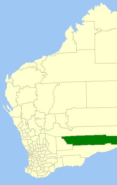
La Cité de Kalgoorlie-Boulder (City of Kalgoorlie-Boulder en anglais) est une zone d'administration locale au sud de l'Australie-Occidentale en Australie à environ 550 kilomètres à l'est de Perth, la capitale de l'État.
La zone est divisée en localités:
- Broad Arrow
- Bulong
- Coonana
- Cundeelee
- Forrest
- Golden Ridge
- Kanowna
- Loongana
- Ora Banda
- Rawlinna
- Zanthus ,
la ville de Kalgoordie elle-même étant divisée en quartiers:
- Kalgoorlie
- Boulder
- Binduli
- Broadwood
- Brown Hill
- Fimiston
- Hannans
- Karlkurla
- Lamington
- Mullingar
- Parkeston
- Piccadilly
- Somerville
- South Boulder
- South Kalgoorlie
- Trafalgar
- Victory Heights
- West Kalgoorlie
- West Lamington
- Williamstown
- Yilkari
La zone a 12 conseillers et n'est pas découpée en circonscriptions.
Liens externes
Catégories :
- Zone d'administration locale de Goldfields-Esperance
- Fondation en 1989
Wikimedia Foundation.
2010.
Contenu soumis à la licence CC-BY-SA. Source : Article Cité de Kalgoorlie-Boulder de Wikipédia en français (auteurs)
Regardez d'autres dictionnaires:
Ville de Kalgoorlie-Boulder — Cité de Kalgoorlie Boulder Cité de Kalgoorlie Boulder Géographie État : Australie Occidentale … Wikipédia en Français
Kalgoorlie — 30°46′38″S 121°30′17″E / 30.77722, 121.50472 … Wikipédia en Français
Kalgoorlie, Western Australia — Infobox Australian Place | type = city name = Kalgoorlie Boulder state = Western Australia caption = pop = 28,242 pop footnotes = (2006 census)Census 2006 AUS|id=5080|name=Kalgoorlie/Boulder (WA) (Statistical District)|accessdate=2008 04 02|quick … Wikipedia
Contenu:Australie — Projet:Australie/Liste des articles Liste mise à jour régulièrement par MyBot (d · c · b) à partir des articles liés au bandeau {{Portail Australie}} Modifications récentes des articles ayant le bandeau de ce portail… … Wikipédia en Français
Zones d'administration locale d'Australie-Occidentale — Les zones d administration locales d Australie Occidentale Il y a 141 zones d administration locale en Australie Occidentale si l on tient compte des deux comtés que sont le comté de l île Christmas et le comté des îles Cocos. Les fonctions de… … Wikipédia en Français
Golden West Network — Infobox TV channel name = Golden West Network logofile = GWN2001.svg logosize = 150px logoalt = GWN Logo launch = March 10, 1967 picture format = 576i (SDTV) share = 67.5% share as of = 2007 share source =… … Wikipedia
Water restrictions in Australia — Water restrictions are currently in place in many regions and cities of Australia in response to chronic shortages resulting from drought. Depending upon the location, these can include restrictions on watering lawns, using sprinkler systems,… … Wikipedia
Electoral district of Eyre — Infobox Australian Electorate name = Eyre state = wa caption = lifespan = 1950–1962; 1989–2005; 2008–present mp = Graham Jacobs mp party = Liberal namesake = Edward John Eyre area = 292240 class = Mining and PastoralEyre is an electoral district… … Wikipedia
Goldfields Water Supply Scheme — The Goldfields Water Supply Scheme, also known by names such as the Goldfields Pipeline, Goldfields and Agricultural Water Supply Scheme (GAWS), and originally known as the Coolgardie Goldfields Water Supply Scheme, is perhaps the world s longest … Wikipedia
Great Eastern Highway — Infobox Australian Road road name = Great Eastern Highway caption = Great Eastern Highway at route route route photo = Great Eastern Highway SMC.jpg|400px length = 595 direction = West East start = finish = est = 1890s through = Northam, Merredin … Wikipedia

 Australie