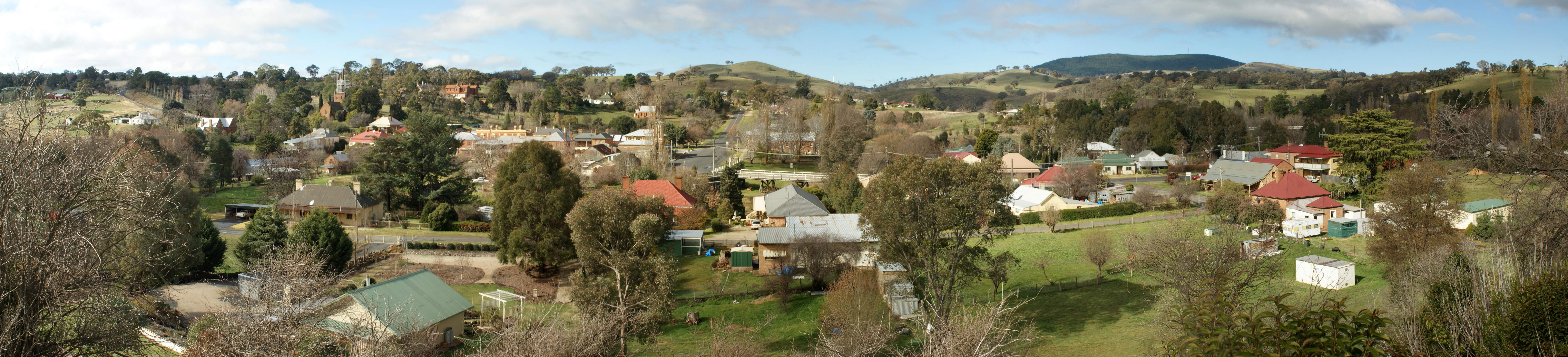
Carcoar
Contenu soumis à la licence CC-BY-SA. Source : Article Carcoar de Wikipédia en français (auteurs)
Regardez d'autres dictionnaires:
Carcoar-Stausee — Carcoar Staudamm von der Wasserseite aus … Deutsch Wikipedia
Carcoar, New South Wales — Infobox Australian Place | type = town name = Carcoar state = nsw caption = Belubula Street lga = Blayney Shire fedgov = Calare postcode = 2791 est = 1839 pop = 400 elevation= 720 maxtemp = 20.9 mintemp = 6.6 rainfall = 784.6 stategov = Bathurst… … Wikipedia
Carcoar — /ˈkakɔ/ (say kahkaw) noun a small town in central eastern NSW, north east of Cowra; declared a historic site in 1974 …
Electoral district of Carcoar — Carcoar was an electoral district of the Legislative Assembly in the Australian state of New South Wales, originally created in 1859 in the Lithgow area and named after Carcoar. It replaced part of Western Boroughs and part of Bathurst (County).… … Wikipedia
Belubula River — Der Carcoar Staudamm am Belubula RiverVorlage:Infobox Fluss/KARTE fehlt Daten … Deutsch Wikipedia
Coombing Park — is a farming property situated in western New South Wales just off the Mid Western Highway about 5 km west of Carcoar,[1] 260 km west of Sydney and 54 km south west of Bathurst. The property is of considerable note because of its relationship… … Wikipedia
Members of the New South Wales Legislative Assembly, 1880–1882 — This is a list of members of the New South Wales Legislative Assembly from 1880 to 1882. Elections for the tenth Legislative Assembly were held between 17 November and 10 December 1880 with parliament first meeting on 15 December 1880. Electoral… … Wikipedia
Members of the New South Wales Legislative Assembly, 1882–1885 — This is a list of members of the New South Wales Legislative Assembly from 1882 to 1885. Elections for the eleventh Legislative Assembly were held between 30 November and 21 December 1882 with parliament first meeting on 3 January 1983. The… … Wikipedia
Neville, New South Wales — Neville is a small village in the south east of New South Wales, Australia, in Blayney Shire. It is 60km south of Bathurst or about 16 km south east of Mandurama. It is 940 metres above sea level and currently has a population of about 100.… … Wikipedia
Members of the New South Wales Legislative Assembly, 1860–1864 — This is a list of members of the New South Wales Legislative Assembly from 1860 to 1864: Name Electorate Years in office Alexander, MauriceMaurice Alexander 4 Goulburn 1861–1872 Allen, William BellWilliam Allen Williams 1860–1864 … Wikipedia
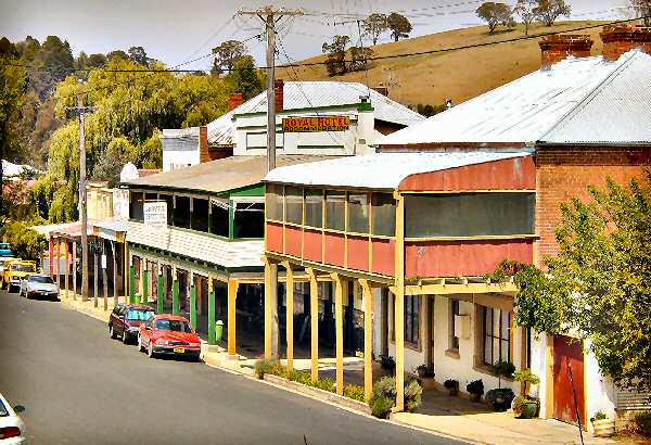
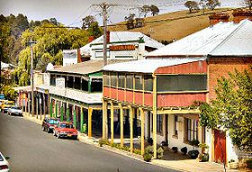 La grand rue de Carcoar
 Australie
 Carcoar